Day 22: Molly, You Hypoxic Girl!

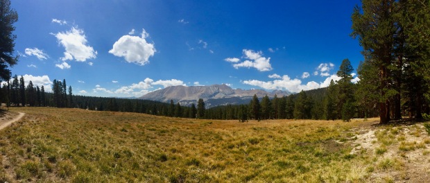
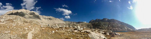
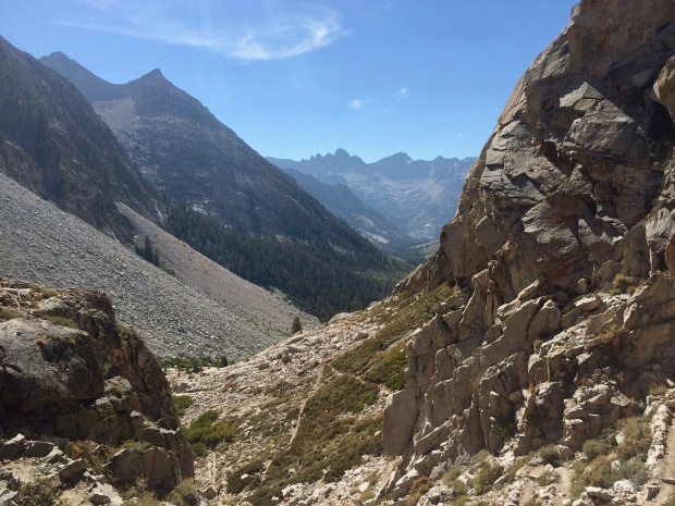
Guitar Lake – Whitney Summit – Whitney Portal (15 miles, 3,035′ elevation gain)

Cumulative Distance: 231.9 miles

Cumulative Ascent: 43,080 feet

Okay. So here I am more than a year after I finished. I actually just recently went back and hiked most of the JMT again with some girlfriends, but that’ll have to come later. Maybe.

Now, where were we?

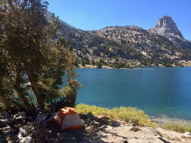
I set my alarm for 0030. The plan was to start hiking around 0100/0130, meet Jace up at the Mt Whitney Trail Junction at about 0500, summit together (hopefully timing it out to get there for sunrise), and then head alllllll the way down to Whitney Portal for a grand finish. It was going to be a long, brutal day.

I barely slept at all, I was so anxious and cold. Little mice kept scurrying around me all night looking for food and dragging hikers’ trash across the rough granite. I thought I was going crazy at first when I was deliriously in and out of sleep hearing what I thought might be the wind or leaves rustling. With no trees in sight, I was confused and sat up to see in the darkness what I was hearing. They were cute, but beyond annoying. Wide awake, I laid back down and watched the first headlights making their way up the giant wall of blackness before me. I wondered why they were all starting so early. It would be another hour or so until my own alarm went off, and I saw the first headlight start leveling out and moving north. They must have made it to the junction. They were insanely high above me and I started to get nervous about hiking alone in the pitch black at such a high altitude. Thoughts of hikers calmly walking off the edge of Everest or K2 to their death started racing through my mind. Hypoxia is no joke. I also kept thinking about all my flight attendant training with our discussions of TUC (Time of Useful Consciousness) during aircraft decompressions and dropping sugar packets on the galley floor to test for hypoxia. Are the sugar packs hilarious? Molly, you hypoxic, girl.

My stomach started to hurt with the anxiety of the trail before me and excitement of seeing my husband for the first time in forever. It was our one year anniversary and we tried to get a permit to meet the day before, but it didn’t work out as planned so we were one day late. I had sent him a HAPPY ANNIVERSARY message from my GPS Transponder yesterday only to realize he was hiking his own hike and wouldn’t have the cell service to receive it.

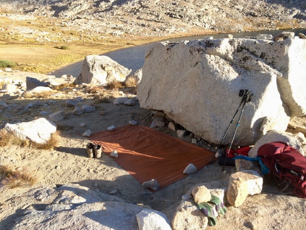
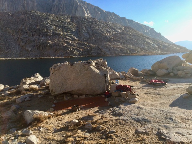
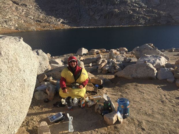
I couldn’t wait any longer, so I started getting ready well before my alarm was set to go off. I heated up some water for coffee and heard some stirring near me. I looked over and saw that Gabriel was awake too even though he had planned to start about an hour after me. “Good morning! Wasn’t expecting you to be awake,” I whispered to him. He hadn’t been able to sleep either. I told him I was planning on leaving early after my cup of coffee because I wasn’t hungry. He scolded me to eat. I’d definitely need the calories if I were to get through the day. He was, of course, right. I forced a giant serving of oatmeal down, gagging throughout the ordeal. It was horrible and the altitude wasn’t helping. After I managed to choke that down, I took a couple bites of a bar, but couldn’t finish it so I threw it in my hipbelt pocket.

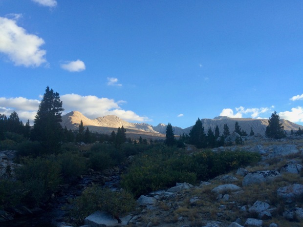
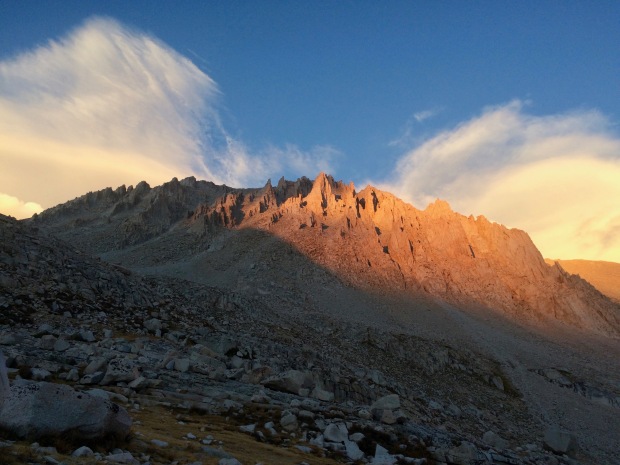
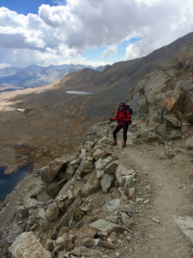
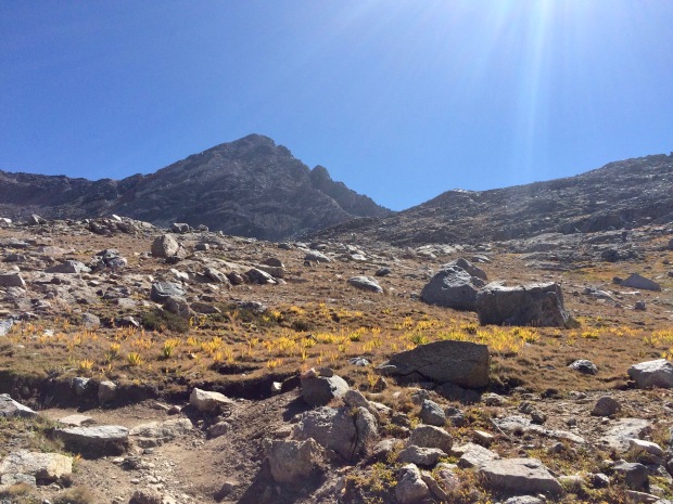
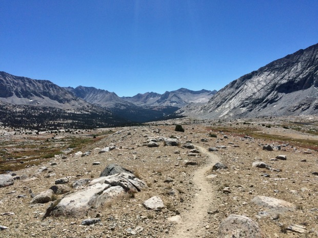
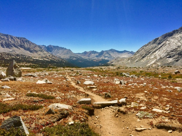
We said our goodbyes and I was off into the darkness with only my headlight lighting the way. I was so scared of falling off the side of the tallest mountain in the lower 48. I had no clue what I was getting into and petrified that it would be Half Dome all over again. What if a gust of wind blew me off a cliff? What if there was ice? What about a landslide? So many unknowns and there I was putting one foot in front of the other in the dead of night. These next seven miles were the hardest of the trail and in complete darkness. It was so cold, I couldn’t feel my face, legs, arms, or feet. The pain was excruciating and my stomach started hurting more.

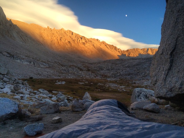
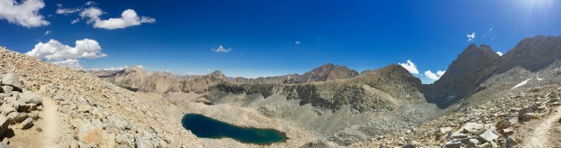
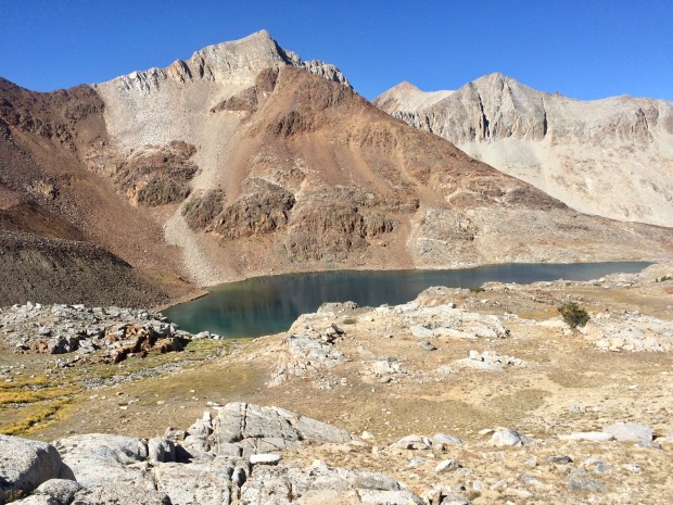
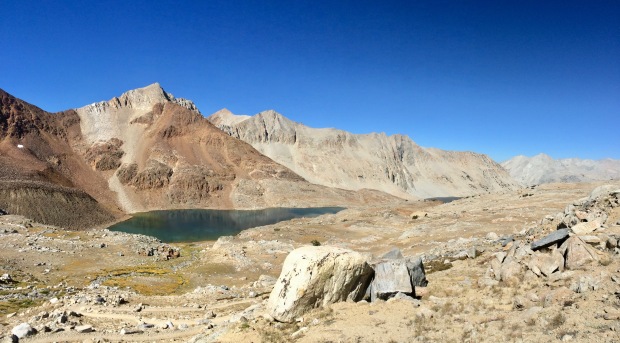
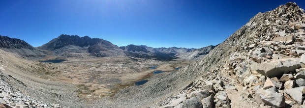
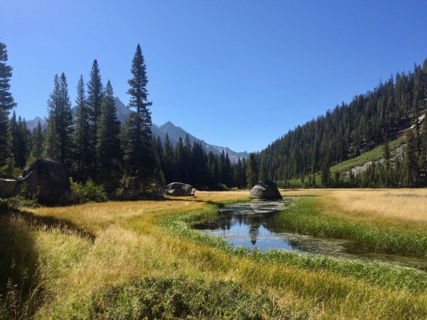
Up and up, G eventually passed me and I kept winding my way up the switchbacks. As I looked up I could see more headlights zig-zagging in the black sky above. It was surreal hiking vertically into a black void. Thankfully, the darkness helped ease my vertigo. I couldn’t see the edge of the cliffs or how far down they would bring my limp body if I fell. The only time I truly grasped how high up I was, was when I started to see a bunch of headlights back down at Guitar Lake 2,000 feet below.

Everything hurt, not in the normal aching way from hiking or the weight of my pack, but because I was completely frozen. I had never been this cold before. I was trying hard to not hike so fast that I’d start sweating because that would ultimately lead to me getting even colder. I kept taking breaks to catch my breath, calm down, and go to the bathroom in my disgusting WAG bag (turns out my stomach issues weren’t just from stress), but my breaks would make me even colder. It was a hard balance to maintain. I couldn’t understand why I felt this way. I had just hiked over 200 miles already and was in pretty goddamn excellent shape at this point averaging 3 miles an hour.

I was starting to feel overcome by so many emotions and doubting myself when I looked up and saw a headlight quickly pacing back and forth maybe 10 or so feet above me. Could that be Jace? Had I already made it up to the junction? I quickly became excited and scurried up another switchback and yelled out to the headlamp before me, “JACE?! IS THAT YOU?!” The bright light started walking toward me and I knew it was him. I started hysterically crying and threw myself into him. Even now, just thinking about that moment, I’m overcome with all the feels. I couldn’t believe our plan had worked and that it was actually him. He was holding up a piece of cardstock with “YOU DID IT BABE!!!” written in sharpie. I’ve never felt so proud of myself as I did in that moment when I saw his face light up. Our whole plan had worked perfectly, too. He had been there for maybe 10 minutes or so when I arrived.

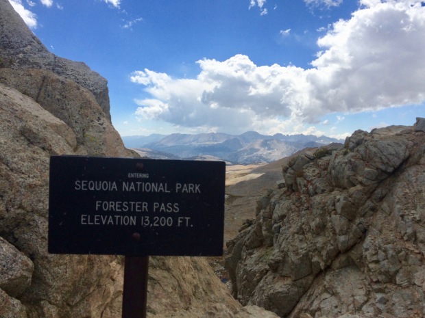
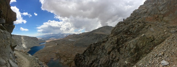
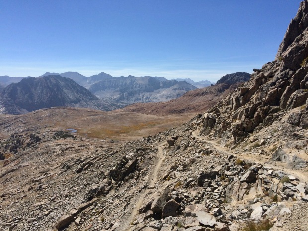
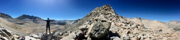
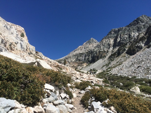
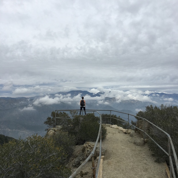
He was freezing as well, so I gave him my rain pants to put on over his to keep the wind from cutting through the fabric. I took my bear can out of my pack, ditched those at the junction, and stuffed my sleeping bag, water, and some snacks into my slack pack to bring to the summit. We’d be coming back down this way again, so I could cut some serious weight and then pick everything back up on the way down.  We had another 2 miles and 1,000 feet of elevation gain until we’d be at the summit.

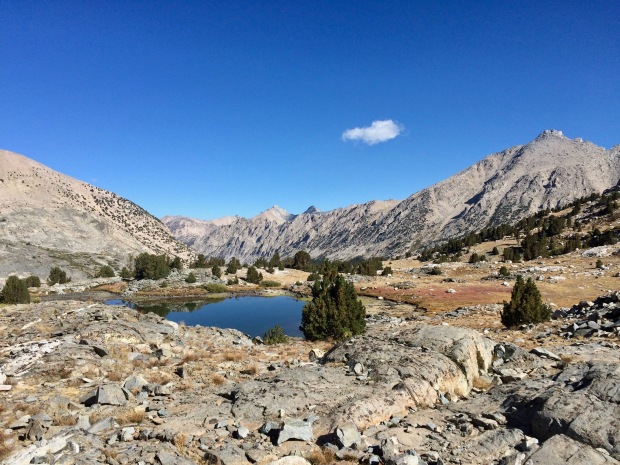
Whitney Trail Junction where I met Jace and ditched my pack

Up and up we went, freezing our asses off. Again, I really cannot even begin to explain how cold it was. I couldn’t wait for the sun to come up so we’d be able to see again and feel its warmth on our bodies. We kept taking turns vigorously rubbing each others hands and legs trying as hard as we could to get warm. I couldn’t feel my fingers anymore at all.

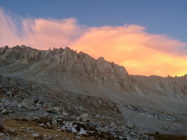
When we got to the final stretch, I don’t exactly remember what happened, but Jace told me to sit down. He said I looked like a deer in headlights and said we needed to turn around. I lost it. I hadn’t come all this way to be within 500 feet of the summit to succumb to hypoxia. I sat there on a rock, bawling my eyes out. The sky was just starting to barely become light and I started worrying that we wouldn’t make it in time for sunrise. We agreed to let me chill for 20 minutes or so to see if this would pass. I drank some water, ate some more of my bar, calmed down, breathed, and started to feel better.

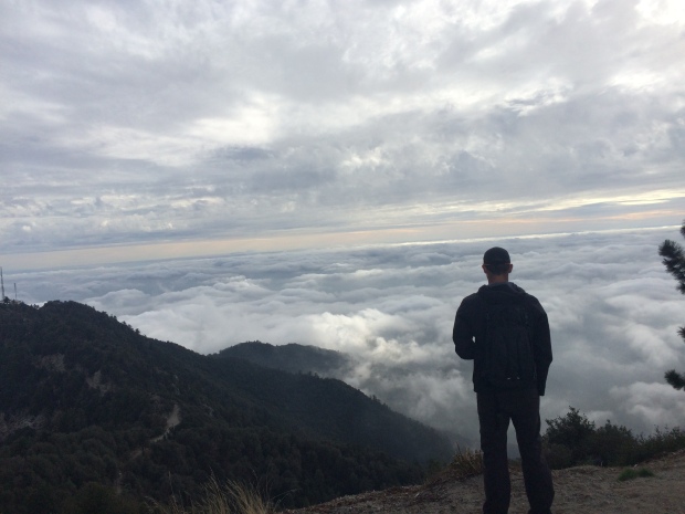
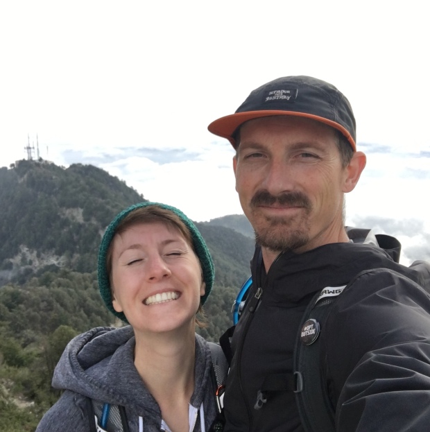
We made the final push to the summit and literally arrived just as the sun peaked up over the horizon. I was surrounded by fellow hikers I had met along the way and it was magical. Everyone was wrapped in sleeping bags and fighting the cold. Someone mentioned that it was 16 degrees. Jace whipped out a bottle of champagne, but we were too cold to drink it. Everyone raced into the emergency shelter to hide from the cold and huddle together. There had to have been at least ten of us in that tiny room, trying to find warmth, congratulating each other, swapping trail stories.

The first peek of the sun from the highest place in the contiguous United States

I have to say, the whole summit experience is a blur. I was so cold, so out of it, so overcome by emotions. Once I got up, all I wanted to do was leave and be able to feel my hands again. I only took a couple crappy photos, and that’s probably what I regret the most. I wish I had more photos of the whole experience- good and bad. Our hands were just too frozen to take any.

We were up there for maybe 30 minutes at most, which also makes me pretty sad. I had wanted to spend at least an hour up there to take it all in. I had stood on the very top of the contiguous United States for only a short moment, but it was incredible.

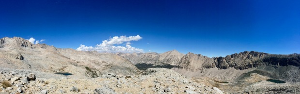
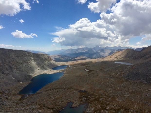
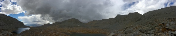
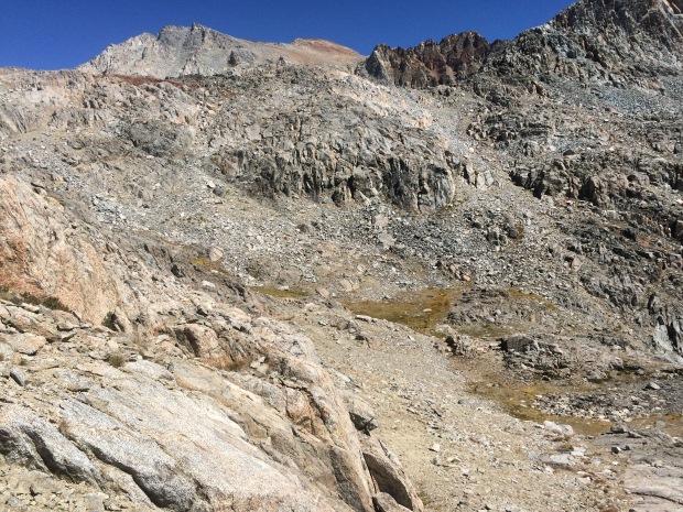
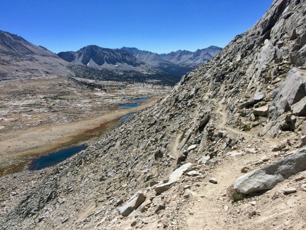
Looking southwest. Hitchcock Lakes below and the slope on the left is Mt. Muir

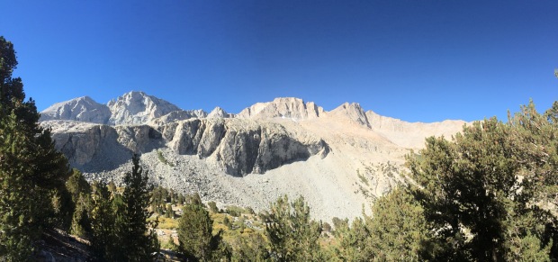
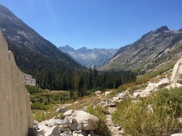
We started back down and within 20 minutes or so I already started feeling better. The sun was up, my mind becoming clear again, and the circulation to my body regained. Now that it was daylight, we could see everything we had just hiked and it was so insane. I was thankful I hadn’t been able to see the sheer drop-offs on the way up. We got a good view of Mt. Muir, which, I have to be honest, kind of pisses me off. He got some “little” guy named after him as we stood on top of Whitney, his arch nemesis. Josiah Whitney called Muir an ignoramus for his theory of glacial formations in the Sierra. Welp, joke’s on you, Jo, because you’re a dolt and Muir was right. But, yeah, Whitney gets the highest mountain in the lower 48 and Muir’s mountain is literally there in Whitney’s shadow? Not cool, man. -___-

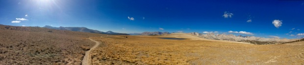
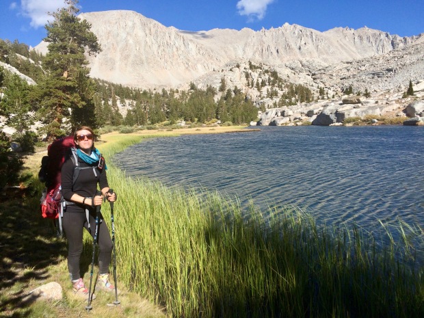
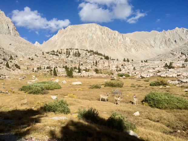
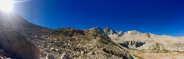
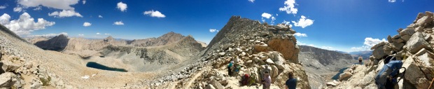
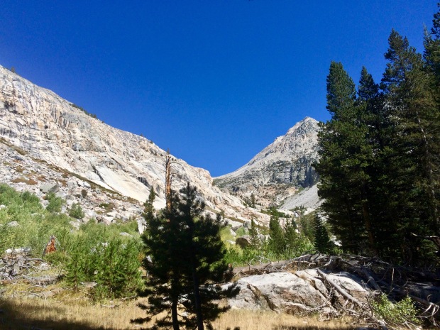
Passing by The Needles, you get glimpses out from their Windows to incredible scenery below. Again, we barely took any photos, so for that I am sorry.

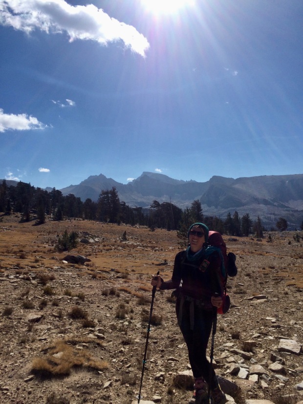
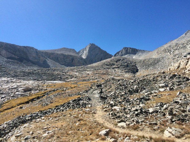
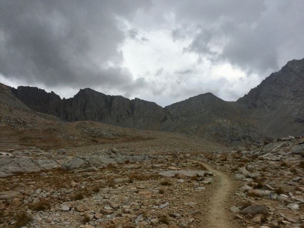
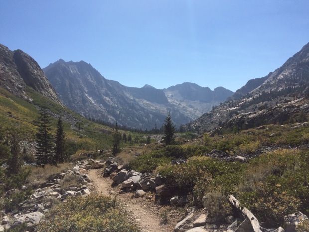
At the junction, I packed up all my things again and said goodbye to the John Muir Trail. The summit had been the official terminus and the trail out to Whitney Portal isn’t technically part of it. We still had more than 8 miles to go and I had heard that the final descent was the hardest part of the trail aside from what I had just done in the dead of night.

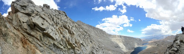
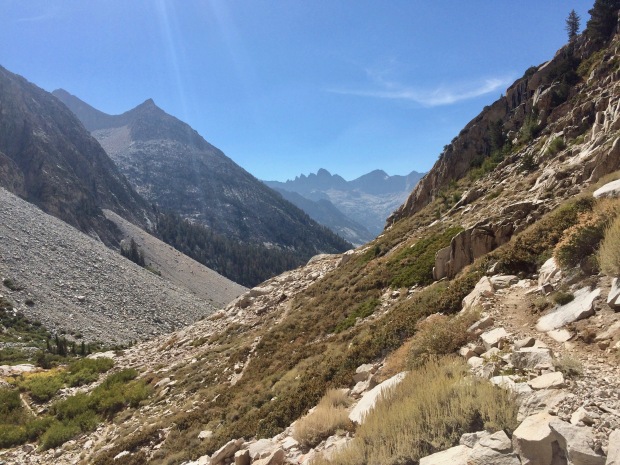
The Needles. Formed by avalanches, in case you wanted to know

Da Needles again. Dat pointy guy in the middle is my homeboy Muir

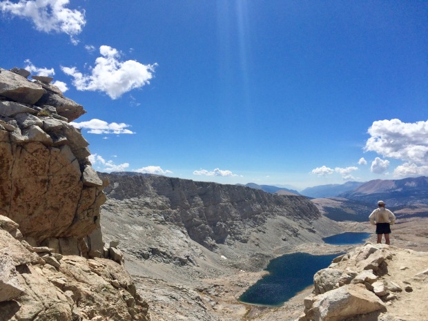
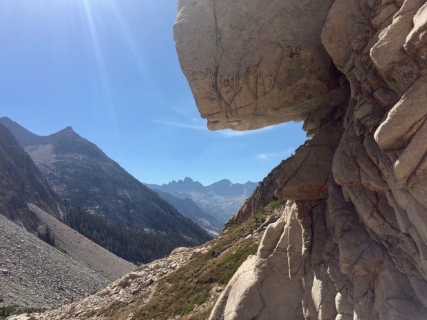
Peering through a window, eastward. The V is Whitney Portal with Alabama Hills and New York Butte behind, respectively

The Needles and Muir, Hitchcock Lakes, Mt. Guyot, the Kaweahs. It’s a party

Another glimpse through a window framing Lone Pine Peak and then Death Valley in the very distance

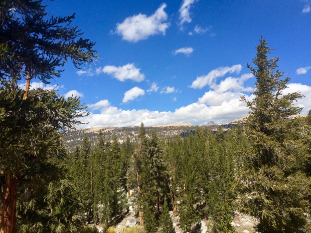
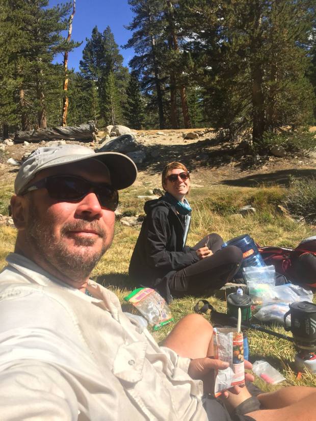
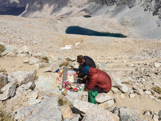
Down and down the famous 99 switchbacks we went. Part of the trail has been blasted away with steel railings and a cable to hold onto as the trail section there is covered in ice almost year-round. Down again until we reached Trail Camp, where Jace had set up the night before. We got to his tent site and ate as he broke down camp. He surprised me with one of my favorite snacks: Oreos! I started crying, Jace took a photo of my insanity, and that photo is now my picture ID on my friend Kellie’s iPhone. Fun fact. I guess.

Aaaanyway, after Jace was all packed up we kept going down. “Only” six more miles or so left and they were the longest six miles of my life.

I twisted my ankle 8743652384562435 times and hurt my knee. I was impatient, exhausted, and couldn’t wait to finish. I had trailhead fever, which caused me to hike like an idiot. Jace made me stop to rest again annnnd, you guessed it, I started crying. I was seriously hurting myself. My foot and knee were in excruciating pain from me twisting them over and over as I tripped my way down the damn mountain. I know better, why was I doing this to myself?

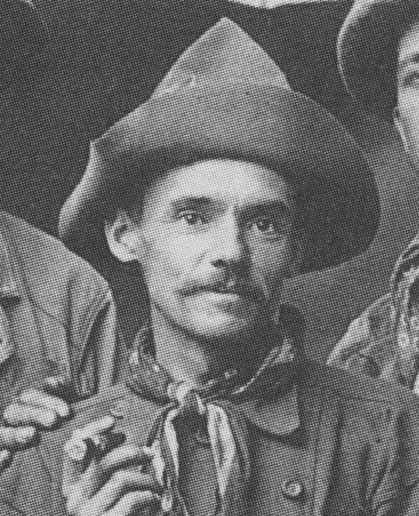
Jace doing his best “ah-hyuck”

Whitney Portal in sight! The end is near!

Finally, we arrived at Whitney Portal and we were greeted with cheers, beers, and food with friends and fellow hikers. It was such a great experience to sit at a table with everyone, especially G, after our incredible journey.

Well, here it is. The end. I should probably have some well thought-out ending to put here, but I don’t. I still don’t have a nice little bow that I can tie on top of this whole experience. I turned out that I had a tiny fracture in my foot from that last day hiking, so that took a while to heal. But it was the mental part that really killed me. Hiking alone for over 200 miles in the wilderness is the most insane thing I have ever done. I loved it. I hated it. I’m so proud of myself. I feel like I can do anything because of the JMT. But immediately after, I said I would never do it again. That feeling gradually turned into a horrible post-hike depression that lasted for months. I was thankful I had other people to reach out to in order to cope with how I was feeling, because part of the depression as you re-renter society is that “no one gets it.” Everything feels fake and wrong and too fast and… you just want to go back into the wilderness.

So I did. Again. A year later with two of my best girlfriends.

Day 21: The End is Near

Shepherd’s Pass Junction – Guitar Lake (11.5 miles, 2,040′ elevation gain)

Cumulative Distance: 228.4 miles

Cumulative Ascent: 42,085 feet

14310461_10210627398869111_6749722726293682848_o

Totally forgot to throw this photo in last time, so here it is now and stuff

You know what’s funny? How I mentioned in my last post how thankful I was that I wrote in my journal each night. Because… well… that stops here. Day 21 was simply Gabriel’s first and last name jotted down in my journal so I could find him on Facebook in case we were to part ways. Day 22… entirely blank. After I finished my hike I kept telling my husband over and over again about how I really needed to sit down and write about my last couple days on the trail before the small details vanished… and now here I am.

To be fair, a lot was going on those last two days. G and I kept trying to grasp at what we were feeling. Had we found what we had sought for? Did the trail solve all our problems? Did I even have any problems at all? Why was I even out here? Our hike to Guitar Lake was a deeply existential one, at least for me. Amidst our normal jokes and laughter, the sadness was closing in around me. My head was spinning and my chest felt tight- not from altitude, but from not being able to properly process all my emotions.

But let’s carry on with the day and I’ll get back to that later.

We had been told by the ever informative Liz that we should have seen our first glimpse of Mt. Whitney yesterday, but with the crazy weather, we hadn’t been so lucky. We woke up to a view out over Tyndall Creek to Tawny Point and kept wondering if it was Whitney way in the distance. Or Mt. Young? Or Mt. Hale? Until we were certain, we didn’t want to count it as the special occasion.

IMG_5353

Is that Whitney peeking out from behind Tawny Point? Hrm. Maybe?

IMG_5354

GUYS. WHITNEY IS OFFICIALLY ON A SIGN. OMGOMGOMGOMGOMG

After Tawny, the views spread out in the most magnificent and vast sandy plain before us: Bighorn Plateau. I was instantly bummed that the weather had held us back, because it is one of the most beautiful places I have ever seen. We saw Tripod and his wife, who had the entire plateau to themselves the night before.

IMG_5357

How insanely beautiful is Bighorn Plateau?!

Then, suddenly, we knew exactly what lay before us was Mt. Whitney in all its glory. It was such a strange and unimpressive view from the northwest, but it stirred up all sorts of intense emotions, regardless.

IMG_5359

That flat, boring looking mountain in the middle is Whitney

IMG_5360

Doesn’t look like the highest mountain in the lower 48 from here, does it?

IMG_5361

Obligatory photo to mark the occasion

We stopped in the late morning for lunch and to soak our feet in a creek, which felt amazing. I had at one point promised myself to take the time to cool off my feet more often, but had unfortunately neglected to do so on most days. Lunch consisted of a tortilla smeared in Nutella and I was thankful I had chosen such a ridiculous meal a month before during meal prep.

IMG_5364

Looking back toward Bighorn, where more clouds were again gathering

IMG_5365

A meadow fit for The Sound of Music

Shortly after, we arrived at Crabtree Meadows and sat down again to eat snacks and come up with a game plan to find another WAG bag. There was supposed to be a box containing them at the junction, but it was unfortunately empty.

IMG_5367

Only 8.3 miles until I’d be standing taller than anyone else in the contiguous United States!!!

14289852_10210627401549178_7888710545054823051_o

Snacks on snacks on snacks

WAG bags. Ugh. Where to start? Waste Alleviation Gelling bags. Soooo, the whole Mt. Whitney zone is becoming quite the haven for human feces. The soil does not break it down and is often too firm to dig a proper cathole. Over the years, human waste has started leaching into the lakes- the only water supply in the area for miles. There used to be a few pit toilets on Whitney, but helicopters and USFS upkeep proved beyond unfeasible with the amount of poo needing to be stirred, shoveled, and flown out each year. Whitney today sees more than 40,000 hikers annually and, well, that’s a lot of poop. Several years ago, USFS and NPS collaborated to mandate that all hikers entering the Whitney Zone carry a WAG bag and use them for all solid waste, which must also be carried back out to be deposited in a human waste bin at Whitney Portal. While not the most glamorous solution, it follows the LNT (Leave No Trace) principle and reduces the exorbitant cost of poo maintenance. Long story short, we needed to grab another one and head on our way.

The trail started its 4,000-foot climb up toward the summit of Whitney. This would be my last major ascent of the John Muir Trail, which tugged on my heartstrings. Skirting around Timberline Lake, a ranger was coming the opposite way and stopped to ask for our permits and talk briefly about our hike. Then not too longer down the trail we crossed paths with a family of mule deer who barely seemed to mind we were there.

IMG_5368

Timberline Lake, the official last stop to poo freely before it goes into a bag

IMG_5369

Timberline Lake and the giant Mt. Whitney at 14,505′

IMG_5370

Only 3,410 feet left of elevation gain until I’d be up there

IMG_5377

Curious cuties

Eventually the ground leveled out and we caught our first glimpse of Guitar Lake. I was expecting way more people to be there, as many other hikers I had met in the past several weeks were all planning on partying there that night.

IMG_5379

Coming up to Guitar Lake!

We found two great sites and set up to cowboy camp for our last night on the trail. It was cold and windy as the sun started to dip, making the evening almost unbearable at times. My teeth started clattering and my body was convulsing. I knew I was becoming hypothermic. After dinner I quickly crawled into my sleeping bag for the rest of the night and did some sit ups to try to build up my core temperature.

IMG_5380

My quaint little setup for the night trying to shield from the wind

IMG_5381

Not too shabby, eh?

IMG_5382

See the guitar?

IMG_5383

Surprisingly not crowded

14372276_10210627401789184_574809399096075370_o

Dinner time

IMG_5398

Snug as a bug

G came over and we read the last part of Liz’s book for the day ahead, which was bittersweet. I lay there starting up at the daunting view of Mt. Whitney looming over me and that sadness I felt all day crept in even closer. G must have known, or was feeling the same way, because he asked me if I’d be okay with us parting ways in the morning. He wanted to finish this hike alone as much as I did.

Tomorrow (tonight) the plan would be to wake up around midnight and hike up to the Whitney Trail Junction in complete darkness where I’d be meeting my husband Jace before continuing on to the summit together. It was our one year wedding anniversary and we had a mountain pass between us. It was crazy to think about how he was just up and over on the other side, probably also looking up at the swirling colors in the sky above Whitney.

IMG_5390

The evening alpenglow spreading across Whitney

IMG_5393

And then the sky lit on fire

IMG_5394

G hanging out for the light show

IMG_5397

Dude.

IMG_5399

Wish this pano didn’t get all cut off and blurry


Darkness came and I was still wide awake, full of anxiety. I don’t think I’d be getting much sleep tonight.

IMG_5410

Best place to fall asleep


Day 20: “There’s a Storm Coming, Harry. And We All Best Be Ready When She Does.”

September 11th: Center Basin Creek Crossing – Shepherd Pass Trail Junction (9.3 miles, 2,680′ elevation gain)

Cumulative Distance: 216.9 miles

Cumulative Ascent: 40,045 feet

We set our alarms for 0600, but decided to sleep in until 0700 and were on the trail by 0830.

My first time cowboy camping was a success! I had a couple moments during the night when I was convinced a coyote or bear was going to walk up and eat my face, but being entirely exhausted has its perks because the thought of death-by-creature-chomp-to-the-jugular doesn’t even seem to phase you and you fall right back to sleep. Noted.

It was definitely harder to get up in the morning because I was a bit colder (tents do actually hold in a lot of heat despite how thin they are), but so easy to get everything together and back on the trail. We had some coffee with breakfast and G marveled at my quick gear packing (my flight attendant skills come in handy on the trail, apparently).

It was another long slog up Forester Pass. I always feel so guilty hiking with others because my uphills require a lot of stops for me to catch my breath. Asthma is the pits, man. But G was patient and kind and never made me feel like I was holding him back.

Throughout my entire hike, I had heard about how much of a bitch Forester can be. It’s the highest pass on the trail aside from Whitney and is notorious for fast-moving storms. This would be the highest I’d ever hiked before, and G kept mentioning when I was going slow and being hard on myself that literally each step was breaking a new record once we got above 11,500′. He was right. Every step counted, even if they were spaced ten years apart at the rate I was going.

IMG_5292

Up and up

IMG_5293

Little tarn as we made our way above tree line

IMG_5294

Up and over this terminal moraine (where a glacier pushed all the earth)

IMG_5295

Another beautiful day in the Sierra Nevada

IMG_5297

Gabriel scoping out the trail ahead on a map- complete with snacks

IMG_5298

A long, never-ending slog uphill

IMG_5307

Lake 12,250 (actual name!) with Forester Pass up there somewhere and Junction Peak

IMG_5308

G in his own Ansel Adams backdrop


aah11

Ansel Adams “Junction Peak” c. 1930s

IMG_5309

Yep, still not there yet. Another 800 feet up to go 

IMG_5311

The King-Kern Divide

IMG_5312

Started way down there in those trees only a few hours before


IMG_5314

Lake 12,250 kind of looks like a 8==D, no?

IMG_5315

Still not there, still beautiful

IMG_5316

So close

IMG_5317

These switchbacks were the death of me

Despite the long morning and all the crappy things I had heard about Forester, I really, really enjoyed it. I felt strong and powerful when we got to the top around noon. Unfortunately for us, there was a GIANT tour group up there as well. Or maybe not unfortunately, because they laid out an incredible smorgasbord (every time I use that word I think of the rat in Charlotte’s Web… anyone else? No?) complete with a cutting board full of meats, cheeses, vegetables, fruits, nuts… We were seriously impressed. Chatting with the two guides, they were annoyed with how much food was being wasted each day so far. They had packed a lot of spicy meals and the group consisted of mostly people from England and Australia… where spicy isn’t necessarily the norm like here in Southern California. They told us about how they’d need to throw out a lot at their resupply stop ahead and we gladly offered to take the extra food off their hands. Habanero cheese (!!!!!), meat (for G), Thai chili lime cashews(!!!), Trader Joe’s honey wheat pretzels (!!!)… it was insane and needless to say we feasted like kings that night.

IMG_5318

MADE IT! Pano of Forester Pass from north to south

IMG_5319

G taking in the wide open views south

IMG_5320

Don’t mind me up here drooling and lurking over your food spread

IMG_5322

Northwest side of the pass and Junction Peak

As we sat up there we saw dark clouds building quickly in the distance and then the distant sound of thunder. I wanted to sit up there forever, but we needed to get down before the storm headed our way. Crossing over Forester Pass officially takes you out of Kings Canyon National Park and into Sequoia National Park, which felt incredible to step into another milestone of this hike. The highest I’d ever been, a new park, my first big storm, cheese. It was a pretty impressive day.

IMG_5323

Sketchy clouds building up out there to the east and in the north and south as well

IMG_5328

Me and G getting a quick photo in before heading down

IMG_5333

Storm? What storm?

IMG_5334

The long, flat Diamond Mesa lines the eastern side of the tarns at Tyndall Creek

IMG_5339

G on the south side of Forester

14425376_10210664854725484_1947238875574296795_o (1)

Incredible trail engineering made this pass possible in 1931

Thank god we did head down, because suddenly it was raining, sleeting, hailing, and thundering all around us. We stopped to throw on our rain gear (the first and only time I actually needed it for the entire 200+ mile hike- super lucky, I guess) and carried on. I had wanted to see a plaque on the southern side of Forrester dedicated to the 18-year-old Donald Downs who had died while working on the trail, but we missed it in our downhill haste.

IMG_5341

Getting darker…

IMG_5342

…and darker

IMG_5344

Picking up our pace to get the hell off the mountain

As we neared the bottom of Forester, we met a girl, Jenny, who asked us about the pass, weather, and trail ahead. She was on a mission to break the world record for female JMT NOBO (supported, I believe?) and this storm was messing up her plan. She had left Whitney that morning and was already at the base of Forester before 1400. Insane. She mentioned how the record was currently set at 3 days and 20 hours- I nearly choked in disbelief. That’s how long it takes me to get my ass up one side of a mountain pass. Sitting here now, I just checked the record and it looks like the storm really did mess her up, because the female record remains unbroken. Womp.

IMG_5345

One last look back up before the storm hit

The rest of the afternoon was actually magical. The other side of Forester drastically drops off into a wide open alpine tundra carved out mostly by glacier, but also the steep walls of Diamond Mesa and Junction peak by avalanche. Hiking in the storm was lovely and I had the biggest smile on my face watching the weather around me change so drastically. Every day before had been the same aside from one near-storm I think on Silver Pass, so the storm was welcomed. I grew up in New England, but have been living out here in California for nearly ten years. It was nice to see actual weather to break up the usual “sunny and 75”- making it a cool (albeit wet), easy downhill hike all afternoon for the next few hours and beyond beautiful. Unfortunately the photos stop here because my hands were so frozen and wet, but I did manage to take a couple videos before the storm got worse:

Our plan had been to make it to Bighorn Plateau for the night, but with the weather being as it was, it wouldn’t be smart to be so exposed if lightning were to strike.

We set up a quick camp at Shepherd Pass Junction to get out of the rain, but eventually decided to stay there for the night. We had a great site near the river and weren’t too far off from where we wanted to be.

My dinner was fit for a Khaleesi and I hadn’t been that full in a long time. It amazed me how much my body had resented food the first half of the hike. I had had to force every calorie down and felt awful. Now, however, I was constantly starving and ravenous at meal time.

As we sat around at camp, Tripod and his wife Lauren passed by. They were aiming for Bighorn Plateau as well and decided to push on into the evening since the weather had calmed down. I was seriously impressed with Lauren, she hurt her ankles and knees weeks earlier, but still pushed on. They had to take it slow so she wouldn’t injure herself any further, but I was constantly yo-yoing with them since back in Yosemite at Cloud’s Rest Junction. We chatted with them for a bit and then they were off.

While sitting around at camp I noticed how one of my toes was suddenly itchy. I took off my socks and discovered this fun little rash down the right side of my (pointer?) toe. (Also check out how disgusting my fingernail is in the second photo…) My sister to the rescue: she sent me the perfect bandaid for just this occasion in one of my resupply buckets along with a note about how I always manage to get some sort of foot injury on all my trips. Thankfully, so far, it was just the mild rash and nothing major.

Before bed we read Wenk’s book out loud (or just Liz as we had endearingly started calling her) and discussed our game plan for the day ahead. Getting up to Bighorn would provide us our very first glimpse of Mt. Whitney. We’d finally have the end in sight, and it stirred up a lot of emotions for me that night. I crawled into my tent and laid there in sadness. Sitting up on top of Forester had tipped the scale for me. I was finally, truly, sad. This adventure, this journey, was coming to an end that I never thought I’d reach and at times often resented. The bad days had been unbearable and the good days had passed by so quickly. But here I was, wallowing in a deep, sudden sadness that it would all soon be over. I didn’t want this hike to end and didn’t know how to process this new feeling quite yet. As I sit here typing all this, I think I still don’t. Blogging about the JMT has opened up emotions I had completely forgotten about. People and days and marmots and rivers I had completely forgotten about until I open up my journal to type them out here on my keyboard. I’m thankful I took the time each night to write about every silly little thing (literally every single marmot, pika, dog, deer, pass, crossing, person, experience, meal… all quickly jotted down in shorthand each night for me to transcribe later, now).

Day 19: Cowboy Camping for my First Time Ever

September 10th: Middle Rae Lake – Center Basin Creek Crossing (10.5 miles, 2,490′ elevation gain)

Cumulative Distance: 207.6 miles

Cumulative Ascent: 37,365 feet

IMG_5250

The morning sun creeping its way toward me and Fin Dome looking out over Middle Rae Lake

I woke up, unrested, and was begrudgingly on the tail by 0730. As I turned onto the main trail from the campground I ran into Mark and was surprised the group was up so early! Apparently, as I had suspected, they hadn’t been that far off from where I was- tucked around the corner and behind some large rocks on the other side of the campground.

It was a long, slow, miserable slog up Glen Pass. I kept looking up at this giant wall in front of me and cursing the hikers who had kept me up the night prior. I could have stopped anywhere and fallen back to sleep. In my journal I wrote that the only thought going through my mind at the top of the pass was, “womp.” If that doesn’t sum up my morning in one word, then I don’t know what would.

IMG_5252

Dragon Peak, the Painted Lady, and Glen Pass. Bring it.

IMG_5255

Standing on the isthmus between Middle and Upper Rae Lakes, Black Mountain reflecting in the water

IMG_5256

Okay, hi, giant wall of doom. I didn’t need sleep anyway. No Biggie.

Glen Pass was a tight squeeze without the normal room to spread out and chill for a bit with a snack to take in the views. The scenery back toward Rae Lakes was astounding, but the expansive view out to the Great Western Divide was behind the far wall of the cwm on the south side. However, its little unnamed tarn was a brilliant shining blue and looked tempting to jump into. There were a bunch of people up there on the pass, so I went, “meh,” and headed down the other side into its cwm.

A cwm, or bowl, or cirque, or corrie- take your pick- is cut out from glacier erosion. The ice and rock debris impact and converge carving out a steep headwall down into a bowl-like shape with three walls. This ice/rock flow leaves a deep tarn in its wake, which, in this case, is the unnamed south side lake seen a few photos down below. Just on the tarn’s other side was a rock glacier hanging out… chilling (heh). I thought it was just a colluvial fan, but turns out I’m wrong and it’s actually a rock glacier that took over the terminal moraine, which is way cooler (heh) anyway.

IMG_5257

Diamond Peak, Black Mountain, some unnamed lakes, and Rae Lakes

IMG_5258

North side of Glen Pass and the teeeeeniest, tiiiiiiniest cloud you ever did see

IMG_5259

And let’s do a little twirl over this way to look down the south side. See how narrow the pass is? Not enough room for morning snack craving hangouts if there’s more than even one little marmot guy up there.

IMG_5261

Looking down the cwm to an unnamed tarn and a little rock glacier peaking out of the shadows

I passed by a couple mule trains on the way down and approached a gorgeous view out over Charlotte Lake and Charlotte Dome. I ran into the whole Palisade Crew at the Kearsarge Pass Junction where they were exiting, parting ways with Tim who would continue on by himself out Whitney Portal.

IMG_5262

Dem switchbacks tho. 

IMG_5263

Looking back up. Hi. Bye.

IMG_5264

Charlotte Dome

IMG_5265

Finally able to get a great view of the Great Western Divide now that I’m out of the cwm

IMG_5266

Mt. Bago and Charlotte Lake with Charlotte Dome way out there

IMG_5267

Okay. I wish this shot didn’t come out so blurry because it’s honestly one of my favorite photos from my entire hike.

IMG_5268

Charlotte Lake

After passing Charlotte Lake I was on my way down to Vidette Meadow, which sits at the base of the imposing near-vertical walls of an arête called East Vidette. Arêtes are formed when two glaciers flow parallel to each other carving out separate valleys with a sharp edge (French: arête) between them. You might remember another arête called The Hermit that I wrote about on Day 13.

Down and down I eventually got to the Bubbs Creek Junction and had to pull over. My insides were on fire and I felt like I would vomit at any moment. The pain was unbearable so I dropped my pack, climbed up onto a flat rock, curled up in a ball on my side, and almost started crying. It came hard and out of absolutely nowhere. My pack’s belt strap didn’t help by adding so much pressure to my stomach. I could feel the blood draining from my face and knew I probably looked awful. I honestly don’t remember how long I stayed there, but it definitely wasn’t just a few minutes. It took every bit of me to force myself up to continue on.

IMG_5270

Je m’arrête to take a photo of the arêtes. East Vidette looking fierce and another, Center Peak, in the distance at the top of Center Basin

IMG_5277

Potentially West Vidette? Maybe? Sure.

IMG_5278

PIKACHU!

IMG_5280

ZOOM!

IMG_5282

East Vidette arête looking down on me, disappointed. “Get your ass up and stop complaining.”

The next day would be Forester Pass, which I had heard horror stories about. It would be the highest I’ve ever hiked and the last major pass until Whitney. I needed to set myself up for success tonight in order to get a good start the next morning. Tim had mentioned a campsite a mile or so past Center Basin Creek crossing, and that would be my ultimate goal, but with the way my stomach was feeling, I’d settle for Upper Vidette Meadow at worst.

So up it was. I kept stopping every 200 feet, wincing in pain. Times like this called for some serious inner-mantra chants. A few that stuck were, “This fucking trail isn’t going to hike its fucking self;” “Too legit, too legit to quit;” and “Every step is literally one step closer, Jaimie.”

It was a painful morning with the struggle up Glen half-awake and now this insane stomach pain, but I somehow managed to get up to Center Basin Creek crossing. I know I’ve said it before, but it’s amazing how it’s 90% mental and only 10% physical. Being alone was a blessing because everything was at my own pace and it proved to me how capable I truly am. Maybe that’s what got me through the bad days- just knowing, deep down, that I was (am) strong enough and letting that inner pride take care of the rest.

IMG_5283

Following Bubbs Creek upstream, Kearsarge Pinnacles on the left

I found a great open site not too far off from the trail next to Center Basin Creek and set up for the night. I was completely alone again for another night and was reflecting a lot on the past 200 (!!!) miles I had put behind me. Despite the bad days, I had a sudden sadness fall over me: I’d be done with this journey in three days. Then what? It was the first time I really sat down and pieced everything together where it finally made sense. Most days were spent looking forward to the next- looking forward, excited to put miles behind me. But that afternoon was different. I was sad that it was all ending.

The occasional hiker would wave as they passed by, most likely trying to get up to that same site I had set out to find along with Tim. Then suddenly I saw a familiar face coming up the trail… “GABRIEL?!”

Let’s bring it waaaaaaay back to my Day 1 post. The day before I started, Jace and I waited in line in Yosemite before the sun came up to grab him a walk-up wilderness permit. We were behind a guy named Gabriel, who I saw one other time at Red’s Meadow, and here he was again!

He came over to chat for a bit and then asked if I’d mind if he camped with me for the night.

We ate dinner together, swapped life stories, and he set up his ground cover. I looked on with envy- I had been wanting to cowboy camp and hadn’t mustered up the courage yet to do so. “You should try it! Just keep your tent set up over there and if you get scared or cold in the middle of the night you can always go back in.” So I pulled the footprint out from under my tent, grabbed my sleeping pad and sleeping bag, and snuggled in for the night. Looking in the distance toward Forester Pass, the clouds were gathering and looking dark. Hopefully the rain would hold off for the night, and fingers crossed I’d get up and over Forester without any storms tomorrow.


IMG_5286

Building clouds making me slightly nervous

Every night in my tent, I’d journal about the day and look over maps for the day ahead. This also included reading about what lay ahead the next day from Elizabeth Wenk’s Essential Guide to the JMT. Gabriel had had a little ritual each night with some other ladies he had been hiking with where they’d read the Wenk book out loud for the section ahead before going to bed. He asked if I was down for doing that, so we took turns reading paragraphs out loud and it was an awesome way to end the night. We laughed at the ridiculous names for some of the wildflowers that we wouldn’t even be seeing this late in the season and passed out.

Little side note here: I have to say that people turn up in your life for all sorts of different reasons. G walking into camp that night changed the rest of my hike and I found in him a dear friend who I look up to and respect endlessly. We’d spend the next couple days hiking together and I couldn’t have asked for a better way to finish those 220 miles to Whitney than with him by my side.

It had been a rough day physically, and I was realizing that mentally I was starting to feel a sadness welling up inside of me that everything would soon be ending. But I had gotten through the day, the stomach pain went away, and the night ended with laughs with a friend. I fell asleep under the stars without a thin sheet of nylon between me and them for the first time in my life.

IMG_5285

COWBOY CAMPING: SUCCESS 

Day 18: My Easiest Day on the Trail

September 9th: Woods Creek – Middle Rae Lake (6.4 miles, 2,100′ elevation gain)

Cumulative Distance: 197.1 miles

Cumulative Ascent: 34,875 feet

I woke up at 0630 to make sure I’d get to Rae Lakes before the crazy influx of weekend backpackers, but didn’t end up leaving camp until shortly after 0800. Oh, yeah. Something I forgot to mention in my last post is that Woods Creek was the lowest I’d be for the rest of my journey until heading down the other side of Mt. Whitney. So I won’t be back below 9,500′ for four more days. Pretty neat. AAAANYWAY…

Overall, it was a pretty uneventful day, and ridiculously easy, so this’ll be a short li’l guy.

Shortly down the trail I came across quite the scene of carnage. Scattered berries everywhere and the remnants of what I’m assuming is a decapitated hawk. It looked super fresh and gave me the heebie jeebies that something was out there… mountain lion? I’ve always grown up knowing felines typically decapitate their prey and pull out some organs, sometimes raccoons and owls… but this was a pretty decent sized hawk. Moving on…

IMG_5220

Poor guy

As I got closer to Rae Lakes, I passed by more people, and the comments from most of the men were so condescending, it took every bit of my feminist pride to carry on to my destination. Lots of mansplaining and snide comments about me being out at Rae Lakes alone… when one dude asked where I was coming from and I replied, “Yosemite” his tune drastically changed and I could tell he was embarrassed for the lecture. Let’s just insert a giant eyeroll here, okay?

Dollar Lake was picturesque and I sat there for a bit on the shore watching some people fish. But the most insanely perfect part of the day was approaching the first glimpse of Fin Dome with meadows and creeks in the foreground. It was as if I were staring at a painting.

IMG_5222

Dollar Lake

IMG_5223

Dragon Peak, the Painted Lady, Fin Dome, and this marshy piece of meadowy heaven

IMG_5224

Entering Rae Lakes basin

IMG_5226

Kinda basin-y

IMG_5227

Oh, yeah. That’s a basin

I eventually approached Lower Rae Lake and skirted my way around to Middle Rae Lake where I was able to grab any site I wanted. I found an established site under a tree up above the water and fell in love. I had the whole area to myself for a couple hours until more hikers showed up. Next to me rolled up the guy who camped next to me at South Fork Kings Crossing- Alan, a retired LAFD who spends his retirement mountaineering all over the world and backpacking on the west coast.  Him and I ended up hiking together here and there the past couple days and I learned a lot from him, especially concerning how to breathe better with my asthma.

I never ended up seeing the Palisade crew at Rae Lakes. Maybe they stayed somewhere else? The camp area is quite large, so there was definitely the possibility that they were only 50 feet from me and I had no idea because of all the large boulders.

IMG_5230

Trail skirting up and around Lower Rae Lake

IMG_5231

Fin Dome

IMG_5234

Dragon Peak, the Painted Lady, and Glen Pass as the backdrop of Middle Rae Lake

I took the afternoon to wash my clothes using my bear can as a washing machine (so weird that it was nearly empty and I wouldn’t be getting another resupply!!!) and aired out my disgusting sleeping bag. I sat down in the water for a while, but the wind was so cold, I couldn’t get myself to fully submerge. I was bummed I wasn’t swimming more on my trip; my expectations were definitely not being met mostly due to keeping on schedule, pure exhaustion, and cold mornings/evenings.

IMG_5236

Airing out my gross sleeping bag. Naw, dude… it’s real gross. Trust me.

IMG_5237

Just me and Fin, hanging out

IMG_5240

Kinda cute

IMG_5241

Obligatory pano

I received a message from Jace on my GPS transponder saying that he was able to change his Mt. Whitney day hike permit to an overnight and still be able to meet me on the 13th! I was stoked for him and excited for our meet up.

IMG_5243

You get an okay-ish idea of the drought by looking at that funky rock

Welp, not much else to really say about this day. It was easy and relaxing and I can understand why everyone is so in love with Rae Lakes.

I took a last look up toward the Painted Lady and Glen Pass looming over me in the distance and crawled into my tent for the night to hide from the crazy wind…

THEN I was woken up by a toooooon of hikers setting up in the middle of the night. They were so incredibly loud and obnoxious. It was an awful night and I wish I had said something, but I was so exhausted I didn’t want to get out of my tent or yell. I knew Rae would eventually get crowded, but it’s not a KOA and the average backpacker is typically super respectful of their neighbors since everyone’s in the same boat of exhaustion. It was a bummer to end on that note because the day had been truly magical.

IMG_5246

Starting to get a serious case of hiker hands. My webbing and palms are white with everything else scorched by the sun and covered in dirt that won’t wash off anymore. This photo doesn’t even do it justice. Probably because of the orange hue cast by my tent.

Day 17: Marmots Just Wanna do Hood Rat Stuff With Their Friends

September 8th: South Fork Kings Crossing – Woods Creek (11.7 miles, 2,090′ elevation gain)

Cumulative Distance: 190.7

Cumulative Ascent: 32,775 feet

It seems as though a day to unwind was exactly what I needed. I slept so much better and woke up ready to take on Pinchot Pass and the day ahead. I was on the trail not too long after 0700 and started my ascent up steep switchbacks. I know I keep saying this a lot, but looking back was just incredible. I had a great view out over Upper Basin to Mather Pass and Mt. Ruskin. I was somehow feeling great for once. The climb leveled out a bit and I made friends with a local neighborhood marmot just trying to do hood rat stuff with his friends. It was my first time actually seeing a marmot active instead of being all plump and perched up on a rock somewhere. Go figure that they know how to move. Who’d a thought?

IMG_5132

IMG_5135

IMG_5140

Hai!

The easy climb lead the trail right to Lake Marjorie, where I stopped for a bit to take in the views. I had wanted to arrive there the night prior, but was glad I stayed at South Fork of the Kings.

IMG_5143

Good ol’ Marge.

IMG_5144

Later, dude.

The rest of the way up to Pinchot was insanely beautiful with a few more unnamed tarns framed-out by the steep walls of what I believe might be Mt. Ickes. The lakes were deep and blue and I bet when the sun hit them juuuust right, they’d glow. (Totally thinking of that scene in The Emperor’s New Groove right now where Pacha is telling Kuzco about his house, btw…)

IMG_5147

Get ready for a bunch of photos of lakes

IMG_5148

This first specimen is quite the beaut

IMG_5149

I mean, LOOK.

IMG_5152

Okaaaaaaaaaaay

IMG_5153

Is this f’real?!

IMG_5158

And another

IMG_5159

Heart eyes

IMG_5160

This is why it takes me so long to get up passes. Every two feet: another photo

IMG_5162

Okay, focus. Almost there.

I got to the top of Pinchot before 11 and hung out up there for a bit with the Palisade crew I had deliriously met two days prior. Turns out, they have actual names, Tamara, Bushon (sp?), Mark, and Tim. There was also a guy up there who just lives in the mountains. He hikes the PCT up and down, stopping into towns here and there as he pleases. He’s in love with the Sierra and has mostly been there for the past few years. Pretty incredible. We snacked up there for a bit and then headed down the other side, past six or so bighorn sheep!

IMG_5164

What a goon

IMG_5166

Greasy hair, don’t care

IMG_5167

North side of Pinchot

IMG_5168

Aaaaand south side

IMG_5169

See ’em? Da sheeps?

IMG_5171

Stunning

IMG_5172

Switchbacks all the way down, with a killer view, and sheep frandz

IMG_5174

Palisade Crew on the ridge


IMG_5179

See the bighorn?

IMG_5180

ZOOM!

It was a dry and hot afternoon in the upper 80s again, but we all ate lunch together next to a lake and I cooled my feet.

IMG_5182

Easy stroll through paradise

IMG_5185

It really doesn’t get more magical than this

IMG_5186

Looking back up at Pinchot

IMG_5187

My next day waaaay ahead in the distance

IMG_5189

Sawmill Pass junction and the man, the mystery, himself.

Then suddenly the scenery drastically changed as we descended into the Woods Creek canyon. It was so steep, it really hurt my feet, ankles, and knees, but the views were incredible. There were crystal clear swimming holes galore and the views down the canyon and up toward Glen Pass- gorgeous.

IMG_5190

Green! Lush! Wind! Water!

IMG_5193

It looks like it drops off into oblivion

IMG_5195

Down into tree line

IMG_5198

Almost there

IMG_5200

Really want to know the name of that mountain :[

IMG_5201

Swimming hole!

IMG_5202

Otter rocks

Down and down to we eventually came to the Woods Creek Trail junction and over the sketchy wooden suspension bridge.

IMG_5204

IMG_5205

Woods Creek Suspension Bridge built in 1988


IMG_5212

Castle Domes and One Person at a Time

We set up camp and had a fire, eating dinner, drinking, smoking and enjoying the night. It was nice to have good company and hear about everyone else’s adventure. After dinner I said goodnight and told them I’d be up early tomorrow- on a mission to hopefully grab a good site at Rae Lakes. The Rae Lakes Loop is a popular 40-mile backpacking trip I had heard many great things about, with Rae Lakes being a favored spot to take a zero day on the JMT. It would be Friday the next day, and Rae Lakes gets pretty blown-out during the weekend. I’d see them there, though, and passed out, excited about Rae Lakes tomorrow.

IMG_5214

Blurry, but mannnnn


Day 16: Mather Pass and the Family Matters Theme Song

September 7th: Upper Palisade – South Fork King’s Crossing (8.3 miles, 1,260′ elevation gain)

Cumulative Distance: 179 miles

Cumulative Ascent: 30,685 feet

Woke up around 0730 and left camp sometime before 0900. I barely slept again. Everything itched and hurt, and I kept fluctuating drastically between hot and cold all night. I woke up incredibly swollen, especially around my eyes. Weird. Maybe it’s the altitude? I’d have to keep tabs on that throughout the day…

Swollen eyelids. Ended up going away, thankfully.

Woke up to a gorgeous view over Upper Palisade Lake

Glancing up toward Mather Pass (the dip)

Slooooowly made my way up Mather Pass seeing a pika on the way (!!!). Mornings were getting harder and harder; every new pass was a slog. Got up to Mather just before 1100and met a bunch of people while we sat around snacking (Kathryn from Philly, Leo from Long Beach- represent!, Jenny, and Dave). While we were standing around, there was a GIANT boom that echoed all around us. It was quite frightening and we couldn’t tell exactly which direction it came from. There were no immediate signs of a rock/landslide around us, so we continued chatting. About 5-10 minutes later there was another boom, this time we all agreed it came from somewhere from the southeast. Was it dynamite? We had no idea, but were thankful it wasn’t anywhere close, whatever it was.

Up and up looking back over Upper Palisade Lake

Little Upper Palisade and the Palisade Range in the distance

Back to my epic surprise playlist real quick: just as I was climbing the final stretch to Mather, the Family Matters theme song came up next under my friend Annalise’s name and I laughed my ass off playing it on repeat until I reached the top. I was having a horrible morning and it was exactly what I needed to cheer me up. I mean, listen to it. (Made a little video for your viewing pleasure if you click that link.)

IMG_5095

MATHER PASS!!!!

IMG_5096

Pano on Mather looking west

IMG_5097

Looking down the other side

IMG_5102

Having others around to take photos was pretty awesome

IMG_5104

One last shot before heading down

Anyways, the whole way down Mather was incredibly easy and beautiful. I spent the whole day listening to music and enjoying myself. I hiked with Leo and Kathryn until we stopped to filter some water, where we met up with the crew I camped next to at Palisade. Kathryn is a marathon runner and had been averaging about 25 miles each day, so she wanted to quickly continue on as she was attempting to finish the trail in I believe 10 days or so. Found out before she left that she has a grandmother with the maiden name of Rousseau somewhere in Massachusetts, maybe Worcester area, which I thought pretty crazy. Small world- wonder if we’re related? Leo and the Palisade crew all headed out as well and I relaxed by the creek for a while.

IMG_5105

Lots of switchbacks descending down Mather

IMG_5106

When you dip, I dip, we dip (Mather Pass)

IMG_5112

Tomorrow’s pass way in the distance

IMG_5115

Strolling through Upper Basin

IMG_5116

The photo does NO justice to how vibrant and red this actually was

At the bottom of Mather I ran into one of my FAVORITE Ladies of the JMT- Rachael(?) (aka Cherry). We swapped trail conditions, talked about LOTJMT, took a photo together, and parted ways.

IMG_5118

LOTJMT!!!!

IMG_5122

Down into lodgepole pine

IMG_5123

Turn around, stick it out! Even marmot’s got to shout…

I arrived at the South Fork of King’s River crossing sometime between 1400 and 1500 and decided to stop for the day, even though it was still early. I was almost an entire day ahead of schedule and really wanted to take care of laundry, my body, and mental health. It almost felt like a zero day since I had so much time to relax. I bathed, washed all my clothes, charged all my devices, laid out in the sun to get a tan, swam around in the river, and did a ton of leg stretches to hopefully sleep better that night.

As the sun started setting a man crossed the river and was struggling to find a campsite for the night. I offered him a small spot next to me and he came over to chat for a second before turning in. I lit a fire for my first time the entire trip and burned any papers I didn’t need anymore. It felt nice to have a fire for once, but as I type this all up now I’m realizing I was actually just above 10,000′ and shouldn’t have since fires are prohibited above that elevation. Oops.

Aside from the morning climb, it was a great day. Treating myself to hiking less than 10 miles was definitely worth it!

IMG_5125

I’m the trouble starter, punking instigator. I’m the fear addicted, danger illustrated…

IMG_5127

Oops.


six.

We interrupt your regularly scheduled program. Sorry. (Not sorry?)

Jace and I have officially been doing what we do for six years, today. He’s a cool cat and I like making these cheesy montage videos. I don’t have a fancy WordPress account, so I can’t directly embed it here, so if you want to check it out, you’ll have to drag your mouse this way and click… right…

 here.

It’s a long song, so either sit back and roll your eyes at how corny we can be or skip to the 3:00 mark where the music starts making you want to dance and stuff and you’ll at least have that. Enjoy!

Day 15: The Dreaded Golden Staircase and Channeling my Inner Disney Princess

September 6th: The Rock Monster –  Upper Palisade Lake (14.3 miles, 2,670′ elevation gain)

Cumulative Distance: 170.7 miles

Cumulative Ascent: 29,425 feet **officially more than Mt. Everest!**

IMG_5028

Starting off the morning downhill

I woke up to the sound of rushing water. I had a couple of frights during the night because I thought I heard a growl, but maybe it was just my stomach or me snoring. Maybe it was a ravenous creature ready to pounce. Shrug. Up and out of my tent, my morning was AMAZING. It started off downhill, which was not the norm. It was easy, leisurely. I actually ENJOYED it, versus my morning grunts and swears as I slogged my way uphill, barely awake. Coffee can only do so much, you know? (You know.) All morning was spent strolling down through Big Pete and Little Pete Meadows. I kept humming and mumbling through the theme song for Pete and Pete, which ultimately lead to me singing any and all Nickelodeon theme songs and various commercial jingles I could come up with. Gator Golf. Ribbon Dancer. Roller Rider. Crossfire. Hey Dude. Salute Your Shorts. All That…

IMG_5029

Wish I could stay in the shade forever

IMG_5031

Langille Peak

The meadows were astoundingly beautiful and there were deer everywhere. When I came to Bishop Pass junction four of them walked right up to me saying hello. It was such a bizarre, unnatural thing for them to do, but I loved every second of it. I stood in place for a while, getting my Disney princess on, interacting with these majestic beasts and looked over to see a few campers just waking up and staring in disbelief at my little animal kingdom magic extravaganza. ::hair flip::

IMG_5033

Glimpsing through the trees to Big Pete Meadow

IMG_5036

Le Conte Canyon and a poor photo of The Citadel to the left

Down and down through Le Conte Canyon I eventually got to Middle Fork Kings junction where I sat down to air out my disgusting Sasquatch feet and eat a nice lunch. More of my favorite- hummus, tabouli, black beans, hot sauce, and olives in a tortilla wrap. This would be the lowest point for the rest of my hike (8,030′) until after going up and over Mt. Whitney. Kind of crazy to realize how much higher the southern part of the JMT is. Pretty much everything else would be above 10,000 feet. A woman and her daughter chatted with me for a while; they were waiting for their food resupply to arrive via mule train. They were looking forward to fresh fruit and my stomach moaned with envy. What a great thing, too, to be out there as mother and daughter being the badasses that they were.

IMG_5037

Grouse Meadows in Le Conte Canyon

IMG_5038

Puppies packing in some food resupplies

A couple hours later I arrived at Deer Meadow, which was my plan for the night. It was still super early, so I took some time to sit down in the shade and look over my maps. I could get a great rest in and start the next morning off with The Golden Staircase (dunn, dunn, DUNNNN!) and then Mather Pass shortly after, orrrr I could embrace the suck and trudge my way up The Golden Staircase in the heat of the afternoon and hope to find a spot somewhere at one of the Palisade Lakes. I was so torn. I had been hearing all morning from passing hikers that the spots at Palisade fill up quickly, that there were hardly any decent sites at all at Lower Palisade, and that it would be a brutal climb with another 3 miles or so until I would hopefully find a place to crash for the night. A man just coming down from Golden stopped to say hi and told me there weren’t many sites left, but that I should get Golden over with and call it a day.

IMG_5043

First glimpse up toward the Palisades

IMG_5050

Remnants of the 2002 Palisade Fire

IMG_5052

One last peek up at the Golden Staircase

So, on I went. I looked up at this massive slab of a stone wall in front of me and mustered up whatever energy I could. Mental preparation is more than half the battle. Positive vibes. You’ve got this. I think I can. One foot in front of the other. And so on.

The climb up the Golden Staircase, in hindsight, wasn’t as bad as I had thought it would be, and I honestly think it was because I really sat down to pump myself up beforehand. Despite how goddamn steep it was, how awful the giant steps were, the seemingly endless switchbacks that dropped off cliffs, the views were crazy magical. It took me forever to get up that ridiculously steep 1,500 foot climb, mostly because I was hot, exhausted, and sore, but also because I kept stopping to look back out over the sweeping views of Palisade Creek in Le Conte Canyon and the incredible Black Divide in the distance. The “staircase” was the last part of the entire John Muir Trail to be finished, back in 1938. Back during Joseph Le Conte’s famous expedition in 1908, only this section and the section that is now Forrester Pass, were unnavigable with stock. As you look around you can see exactly where dynamite was used to carve out the impressive switchbacks up the cliffside.

[Can we take a moment to talk about my homeboy Le Conte for a second? Because I Le Can’t. Le sigh. He’s a megababe and set the bar hiiiiigh, gents. So take notes. Ladies, take a seat, grab that glass of wine I know you’ve got right over there and let’s have a chat: Joseph, aka Little Joe, was a naturalist and held a Masters in Mechanical Engineering. Within a week of the Austrian discovery of the X-Ray, Le Conte read the research paper, built HIS OWN X-Ray machine, and x-rayed a bullet inside a boy’s arm. He later went on to be a professor at UC Berkeley for 45 years. Le Conte was also a mountaineer and explored the Sierra Nevada from a young age eventually creating the very first map of the central Sierra, which he submitted to the Sierra Club. He pioneered a 1908 trip from Yosemite to SEKI, which is essentially today’s JMT. In the 1940s Ansel Adams adored Le Conte’s photography and released it to the Sierra Club. I mean, the guy even met his wife in the Sierra Club and they married in Yosemite. After Muir’s death, Le Conte became the second president of the Sierra Club, considering he was a lifelong member and founder. He basically created the John Muir Trail and dedicated it in his buddy’s name. Oh, and that mustaaaaache. So yeah, I know, I know, we’re supposed to be all oooo, ahhhh, le sigh, John Muir, but come ooooon, Joe is a dreamboat. Amirite? Intellectual. Naturalist. Engineer. Mountaineer. Pioneer. Professor. Cartographer. Photographer. Romantic.]

Joseph_N._LeConte

Mustachioed, bandana-wearing, cigar-smoking, confident Le Conte. Dreamy. 


Screen Shot 2017-04-21 at 3.19.13 PM

Le Conte’s photo of future wife Helen Gompertz, her sister, and Le Conte’s sister. They were the first to ever summit University Peak (which they thought at the time was the highest peak in the Sierra). Badass ladies and no woooonder Helen and Joe ended up together.

Anyways…


IMG_5055

Onward. Upward.

IMG_5057

Quickly up and out of Deer Meadow looking back toward the Black Divide

IMG_5058

Beginning the Golden Staircase climb

IMG_5060

Exposed, but what a campsite. Wish I had time to stop and stay here for the night

IMG_5061

Mt. Shakspere, perfectly framed Devils Crags, and Wheel Mountain

Just when I needed it, a woman coming down yelled out, “You’re doing a GREAT job!!!” and suddenly I felt an immense sense of pride wash over me. Holy shit. I’m doing this. I’ve done this. All this behind me? Yeah, I came from freaking Yosemite! [Side note: I’ve made it a personal mission to always praise struggling hikers since the JMT. It’s amazing how much it helps when someone tells you that you’re a beast. It might not register at first, but, oh man, it feels so good when you need it.]

I passed by some guys heading down for the day with heavy equipment, tools, and generators in hand. They had been working on the trail all day- all week- and would head back up the next morning. I thanked them for all their hard work and continued up.

IMG_5062

Blasted cliffsides and seriously impressive switchbacks cut the way up the Golden Staircase

IMG_5064

Can’t get enough of those Devils Crags way out there

IMG_5065

So. Many. Steps. The Golden Staircase seems endless when you’re looking up

IMG_5066

Every photo is a great excuse for a few extra breaths

IMG_5068

The Golden Staircase winding its way through some trees

IMG_5069

I did it! Le Conte Canyon and the Black Divide in all their glory

On and on I eventually got to Lower Palisade and promised myself I’d grab the first site I saw, no matter how crappy. Beggars can’t be choosers, ya know. Welp, that plan got drawn waaaay out. There were hardly any “sites” to begin with, and they were all taken. I prayed that if I kept going I’d find some room for the night- my body was fighting against me and needed to stop. Everything hurt. But the first glimpse up in the sky to the 14,000-foot Palisades towering over me were jaw-dropping. Another mile or so later I stumbled into some trees at Upper Palisade and met a man who must have thought I was dying. The look on his face was of nothing but concern. I only remember muttering something incoherent like, “wherecamp?” as one syllable and he ushered me over to a spot left behind a big rock where him and his group were set up for the night. I was so tired I couldn’t even muster up the energy to be polite, so I nodded their way with a quick “hello,” threw down my gear, set up camp, and started settling in for the night.

IMG_5070

Lower Palisade Lake and the top of Mt. Shakspere

IMG_5071

Lower Palisade Lake

IMG_5072

When you don’t know if you’re in the Sierra or the Caribbean 

IMG_5074

Mather Pass is that deep dip in the distance and here I am wishing I could stop here at Lower Palisade Lake

[The photos ended there, another clear sign of exhaustion. You wouldn’t even know I was surrounded by another alpine lake and the insanely gorgeous 14,000-foot Palisades because this crumb bum was in a bad mood and couldn’t be bothered to take photos.]

I ventured over to filter some water and noticed that I had a vicious cough. In fact, now that I thought of it, I had been coughing a lot for the past few days. I started to worry about AMS, Acute Mountain Sickness, which is a form of altitude sickness. It wasn’t a normal cough, it was dry and it hurt and it was hard to stop once I started. I’m sure my asthma wasn’t helping. Now that my delirium from the climb was starting to subside, I started paying more attention to what my body had been saying. My chest and ribs were sore and my throat was dry. I really needed to slow down and concentrate more on my breathing exercises. At this point, I had climbed more than the height of Mt. Everest over the past couple weeks.

Back in my tent I was dreaming of the mother and daughter I met back at Middle Fork Kings junction. Apples. Fresh apples, they said. And then suddenly: Root beer. Dr. Pepper. Lolas (a mexican restaurant here in Long Beach). Greek food. I was so hungry.

“My feet and legs. I want to cut them off. They’re useless. I wake up in the middle of the night in pain. Hurts so bad. Can’t wait for massage mani pedi Korean spa” I wrote in my journal that night before passing out haaaaard.


Mt. Wilson


pano

We have been all about challenges lately, both challenging ourselves and signing up for challenges we come across on the interwebz. We’re excited to jump into the 52HikeChallenge which is, you guessed it, 52 hikes in a year. A16 is hosting some amazing gigs this year as well that we’ll be posting about soon. But this last hike was aimed to kick off our 6PackofPeaks challenge run by SoCal Hiker.

The challenge is made up of Mount Wilson, Cucamonga Peak, Mount Baldy, San Bernardino Peak, Mount San Jacinto, and San Gorgonio. With the recommended routes, it equals over 27,000′ vertical gain at just over 80 miles on the trail.

6 peaks

SoCal Hiker’s Six-Pack of Peaks Challenge

Considering that a few of these peaks are currently under snow, we started with Mt. Wilson the other day.

We were fairly warned about the insane amount of people who go to Chantry Flats, which is where our hike started. With advice to start early (the gate opens at 0600), we arrived around 0930, which was obviously way too late. We had to park our car about a mile away from the main parking lot, adding two total miles to our hike right off the bat, but we weren’t too worried. This spot also requires an Adventure Pass, which we had already purchased for the 2016 season. Make sure your pass is displayed and easily visible on your dashboard or hanging from your rearview mirror, as we noticed many people were getting tickets for not having one. Another thing to note if you have to park down the road is to pay close attention to parking signs and the white shoulder line on the road. Tons of people were getting ticketed because their car wasn’t completely within the designated shoulder area within the white line.

We started hiking from our car just after 1000 up to the trailhead which is to the right of the  toilets at the lower parking lot.

Our first mistake was skipping the side hike to Sturtevant Falls. By doing so we missed our trail and ended up following the posted sign to Mt. Wilson via the Upper Winter Creek Trail, which would have been fine, but we somehow managed to hop on the Mt. Zion Trail before realizing we should have been at Spruce Grove Camp by that point. However, the wild flowers on this part of the trail were untouched and beautifully in bloom, which was a nice treat.

IMG_1187 IMG_1186 IMG_1150 IMG_1149 IMG_1148 IMG_1141


We decided that even though we were already over three miles off course, we’d continue back down to Spruce Grove and continue on from there. On our way, we crossed paths with two California mule deer.

We met up with Sturtevant Trail and quickly came to the most difficult part of the hike up numerous switchbacks. This area is steep and with every single switchback you wonder how much longer until the top. Eventually you’ll get to the wooden Halfway Rest sign (1.4 to Wilson and 1.4 back down to Sturtevant), which was ironically hopeful instead of daunting. We knew how much farther until the top and powered onward and upward.

"Whoooa, we're halfway theeere!"

“Whoooa, we’re halfway theeere!”

We had picked an amazing day to hike. The weather was cold with the occasional light rain shower. When we arrived at the top of Mt. Wilson, the view was incredible above the clouds. We could see nearby peeks peeking out through the top. Every now and then we would stop to watch the quickly moving weather sweep across the mountains.


top

jaimietop

A nice little vista point at the top

Jace taking in the view

Jace taking in the view

With time not exactly on our side, we were bummed to not be able to enjoy the museum and check out all the different telescopes. We followed the paved road past all the structures to the main parking lot to meet up with the Winter Creek trailhead via Mt. Wilson Toll Road. We took a minute to walk over to the boulders at the end of the lot to look down over LA, but the cloud cover blocked our view, which was still an incredible sight. Glancing back over our shoulders at the Cosmic Cafe, we wished we had time to grab a hot cup of anything to warm us up before heading down.

mt wilson trails map

Following the trail on the right side of the parking lot, it eventually intersects with the toll road. Continue downward on the trail to the left and when you come to a large bend to the right, you’ll see a sign for Winter Creek Trail on the left.

We continued down to Winter Creek with our knees aching. It’s always funny how much you look forward to descending on your way up, just to end up regretting that feeling on you way down.

ominous-looking fog

We arrived at Hoegee’s Camp with the sun starting to set. At this point you can either follow Lower Winter Creek Trail and then climb a short distance back up to Chantry Flats or follow the longer Upper Winter Creek Trail to come out on top of Chantry Flats. We wanted to try to get to our car before dark, and actually looked forward to a bit of an uphill climb at the end, so Lower it was.

As we hiked along the creek all of a sudden we noticed hundreds and hundreds of red salamanders all over the trail. Whenever we came to a crossing we’d look into the water and saw them huddled around rocks in the pools. Turns out, they are California Newt and it was most definitely mating season. Also turns out that the glands in their skin secrete a toxin stronger than cyanide, which can actually kill humans if ingested or through cuts in the skin.

Cute, yet deadly

Cute, yet deadly

Our hike was incredibly slowed for most of the remainder of the trail down due to avoiding the litter critters. We had to turn on our headlamps to make sure our path was clear.

Right before the sun set, we each heard a rumbling in the leaves next to us and some heavy steps. We both froze and immediately looked at each other with the face of, “Oh shit, did you hear that too?!” We turned off our lights and tried to see what was making so much noise. Up the hill a bit we saw what looked like either a baby or adolescent black bear either digging or dragging something. Not wanting to discover if mom was around, we quickly hurried away.

After a short hike back up to Chantry Flats and down the road, we arrived at our car well into the evening. The drive back down the mountain was beautiful with the views of all the lights from Los Angeles below.

With our silly detour and the added mileage to and from the car, our day ended with over 19 miles and about a 6,000′ elevation gain.

Our first summit of the Six-Pack of Peaks challenge: Complete!

Squinty-Mc-Squinters

Squinty-Mc-Squinters