Day 21: The End is Near

Shepherd’s Pass Junction – Guitar Lake (11.5 miles, 2,040′ elevation gain)

Cumulative Distance: 228.4 miles

Cumulative Ascent: 42,085 feet

14310461_10210627398869111_6749722726293682848_o

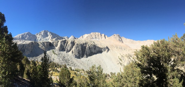
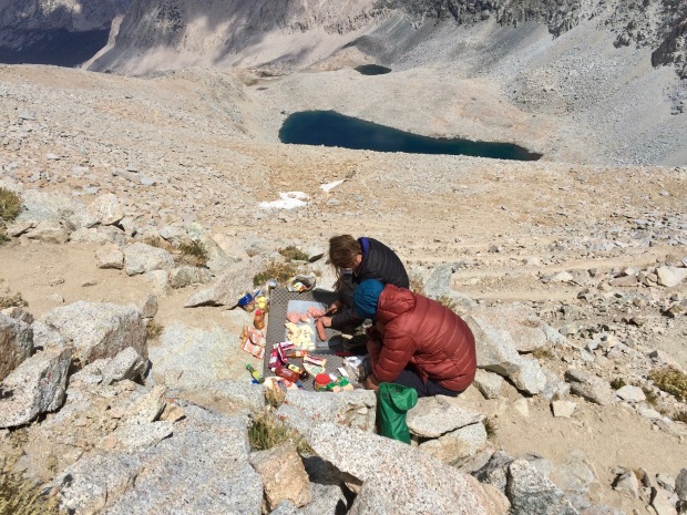
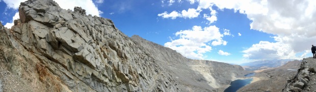
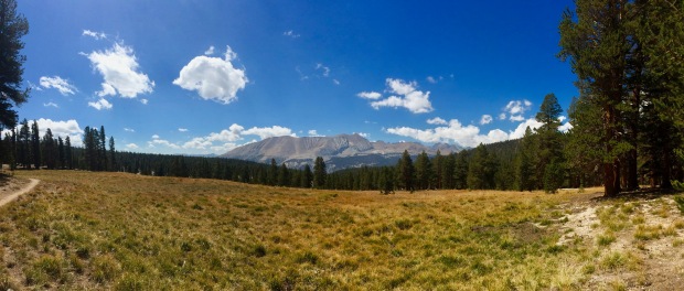
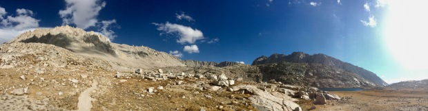
Totally forgot to throw this photo in last time, so here it is now and stuff

You know what’s funny? How I mentioned in my last post how thankful I was that I wrote in my journal each night. Because… well… that stops here. Day 21 was simply Gabriel’s first and last name jotted down in my journal so I could find him on Facebook in case we were to part ways. Day 22… entirely blank. After I finished my hike I kept telling my husband over and over again about how I really needed to sit down and write about my last couple days on the trail before the small details vanished… and now here I am.

To be fair, a lot was going on those last two days. G and I kept trying to grasp at what we were feeling. Had we found what we had sought for? Did the trail solve all our problems? Did I even have any problems at all? Why was I even out here? Our hike to Guitar Lake was a deeply existential one, at least for me. Amidst our normal jokes and laughter, the sadness was closing in around me. My head was spinning and my chest felt tight- not from altitude, but from not being able to properly process all my emotions.

But let’s carry on with the day and I’ll get back to that later.

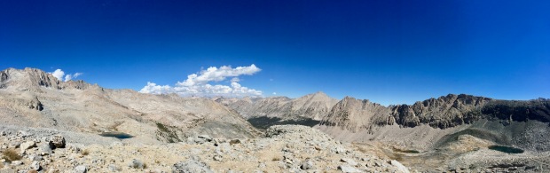
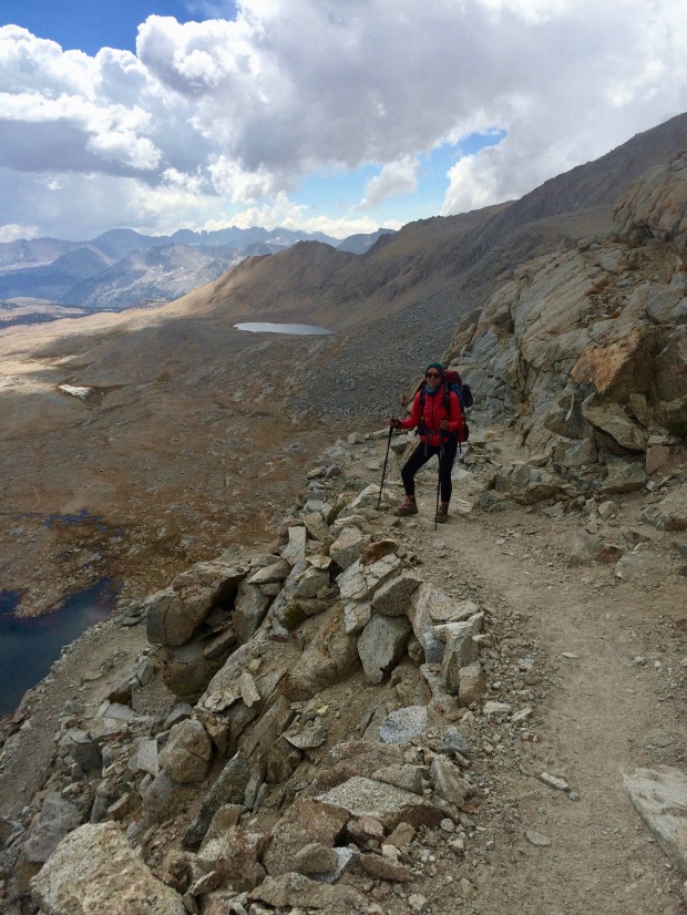
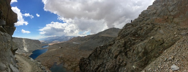
We had been told by the ever informative Liz that we should have seen our first glimpse of Mt. Whitney yesterday, but with the crazy weather, we hadn’t been so lucky. We woke up to a view out over Tyndall Creek to Tawny Point and kept wondering if it was Whitney way in the distance. Or Mt. Young? Or Mt. Hale? Until we were certain, we didn’t want to count it as the special occasion.

IMG_5353

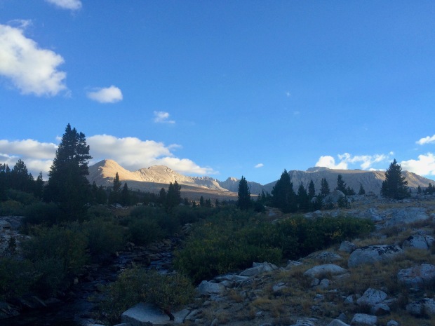
Is that Whitney peeking out from behind Tawny Point? Hrm. Maybe?

IMG_5354

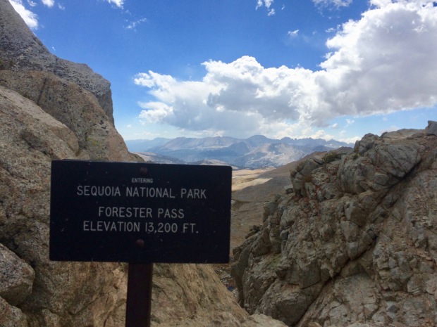
GUYS. WHITNEY IS OFFICIALLY ON A SIGN. OMGOMGOMGOMGOMG

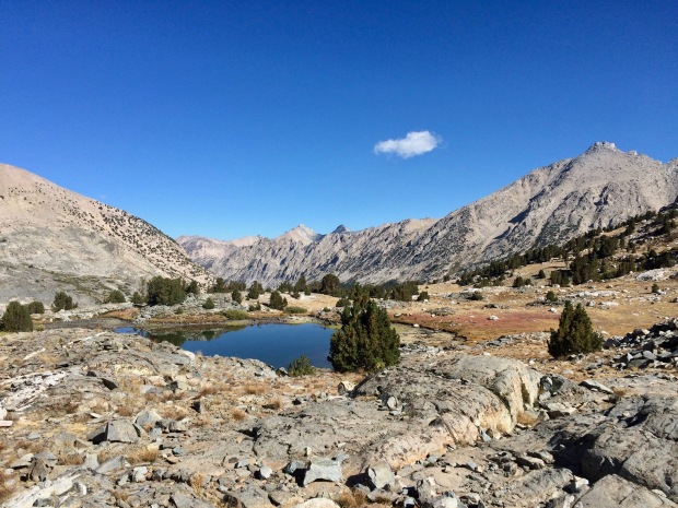
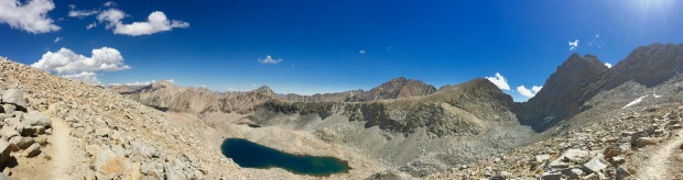
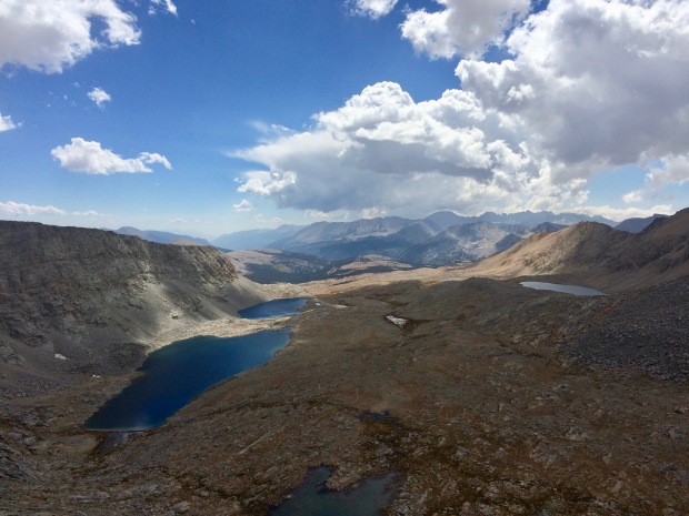
After Tawny, the views spread out in the most magnificent and vast sandy plain before us: Bighorn Plateau. I was instantly bummed that the weather had held us back, because it is one of the most beautiful places I have ever seen. We saw Tripod and his wife, who had the entire plateau to themselves the night before.

IMG_5357

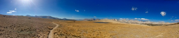
How insanely beautiful is Bighorn Plateau?!

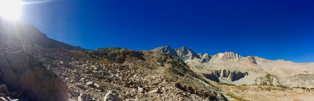
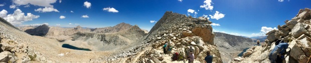
Then, suddenly, we knew exactly what lay before us was Mt. Whitney in all its glory. It was such a strange and unimpressive view from the northwest, but it stirred up all sorts of intense emotions, regardless.

IMG_5359

That flat, boring looking mountain in the middle is Whitney

IMG_5360

Doesn’t look like the highest mountain in the lower 48 from here, does it?

IMG_5361

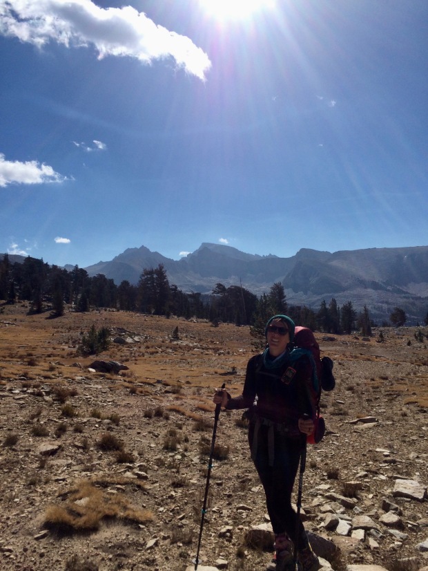
Obligatory photo to mark the occasion

We stopped in the late morning for lunch and to soak our feet in a creek, which felt amazing. I had at one point promised myself to take the time to cool off my feet more often, but had unfortunately neglected to do so on most days. Lunch consisted of a tortilla smeared in Nutella and I was thankful I had chosen such a ridiculous meal a month before during meal prep.

IMG_5364

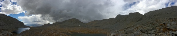
Looking back toward Bighorn, where more clouds were again gathering

IMG_5365

A meadow fit for The Sound of Music

Shortly after, we arrived at Crabtree Meadows and sat down again to eat snacks and come up with a game plan to find another WAG bag. There was supposed to be a box containing them at the junction, but it was unfortunately empty.

IMG_5367

Only 8.3 miles until I’d be standing taller than anyone else in the contiguous United States!!!

14289852_10210627401549178_7888710545054823051_o

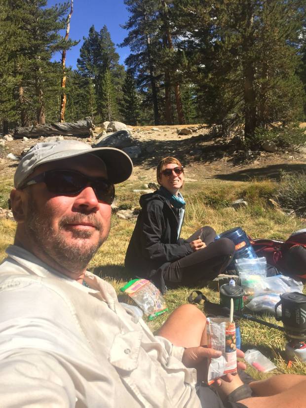
Snacks on snacks on snacks

WAG bags. Ugh. Where to start? Waste Alleviation Gelling bags. Soooo, the whole Mt. Whitney zone is becoming quite the haven for human feces. The soil does not break it down and is often too firm to dig a proper cathole. Over the years, human waste has started leaching into the lakes- the only water supply in the area for miles. There used to be a few pit toilets on Whitney, but helicopters and USFS upkeep proved beyond unfeasible with the amount of poo needing to be stirred, shoveled, and flown out each year. Whitney today sees more than 40,000 hikers annually and, well, that’s a lot of poop. Several years ago, USFS and NPS collaborated to mandate that all hikers entering the Whitney Zone carry a WAG bag and use them for all solid waste, which must also be carried back out to be deposited in a human waste bin at Whitney Portal. While not the most glamorous solution, it follows the LNT (Leave No Trace) principle and reduces the exorbitant cost of poo maintenance. Long story short, we needed to grab another one and head on our way.

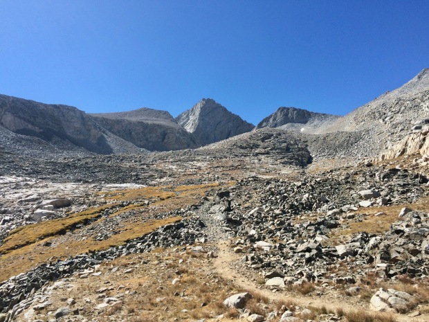
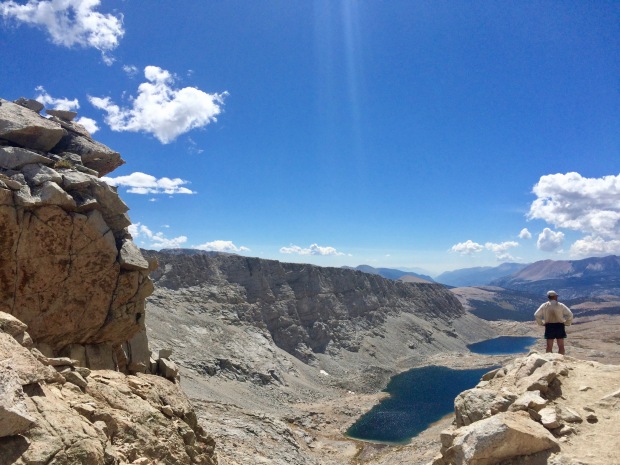
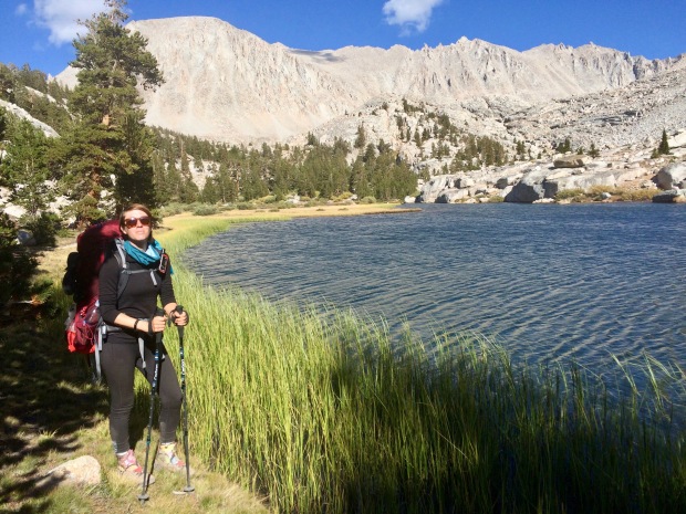
The trail started its 4,000-foot climb up toward the summit of Whitney. This would be my last major ascent of the John Muir Trail, which tugged on my heartstrings. Skirting around Timberline Lake, a ranger was coming the opposite way and stopped to ask for our permits and talk briefly about our hike. Then not too longer down the trail we crossed paths with a family of mule deer who barely seemed to mind we were there.

IMG_5368

Timberline Lake, the official last stop to poo freely before it goes into a bag

IMG_5369

Timberline Lake and the giant Mt. Whitney at 14,505′

IMG_5370

Only 3,410 feet left of elevation gain until I’d be up there
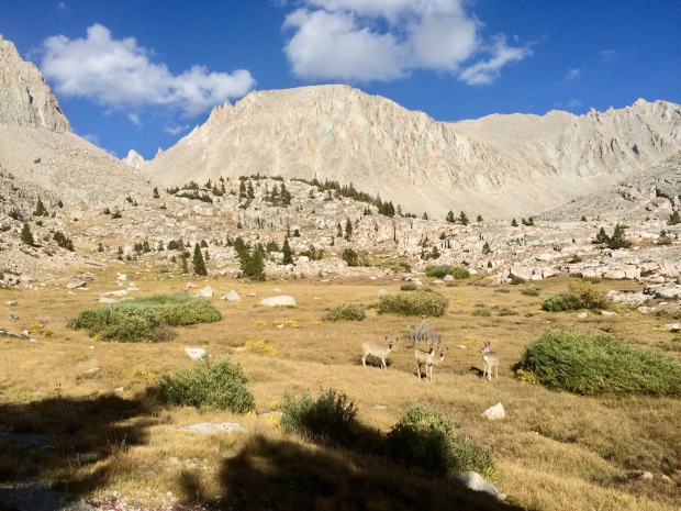
IMG_5377

Curious cuties

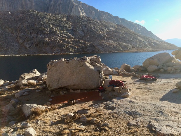
Eventually the ground leveled out and we caught our first glimpse of Guitar Lake. I was expecting way more people to be there, as many other hikers I had met in the past several weeks were all planning on partying there that night.

IMG_5379

Coming up to Guitar Lake!

We found two great sites and set up to cowboy camp for our last night on the trail. It was cold and windy as the sun started to dip, making the evening almost unbearable at times. My teeth started clattering and my body was convulsing. I knew I was becoming hypothermic. After dinner I quickly crawled into my sleeping bag for the rest of the night and did some sit ups to try to build up my core temperature.

IMG_5380

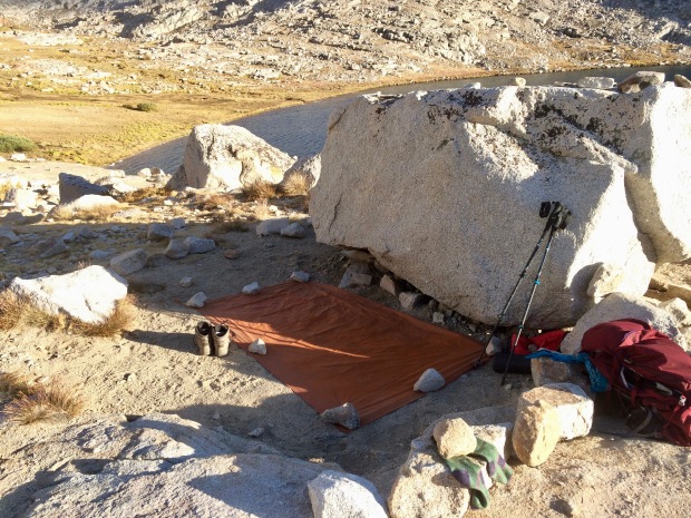
My quaint little setup for the night trying to shield from the wind

IMG_5381

Not too shabby, eh?

IMG_5382

See the guitar?

IMG_5383

Surprisingly not crowded
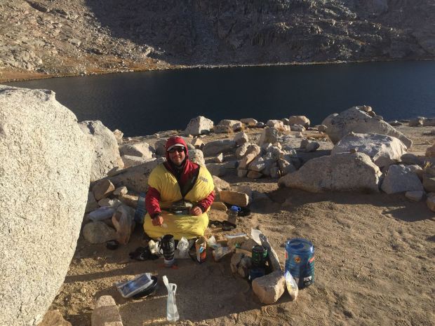
14372276_10210627401789184_574809399096075370_o

Dinner time

IMG_5398

Snug as a bug

G came over and we read the last part of Liz’s book for the day ahead, which was bittersweet. I lay there starting up at the daunting view of Mt. Whitney looming over me and that sadness I felt all day crept in even closer. G must have known, or was feeling the same way, because he asked me if I’d be okay with us parting ways in the morning. He wanted to finish this hike alone as much as I did.

Tomorrow (tonight) the plan would be to wake up around midnight and hike up to the Whitney Trail Junction in complete darkness where I’d be meeting my husband Jace before continuing on to the summit together. It was our one year wedding anniversary and we had a mountain pass between us. It was crazy to think about how he was just up and over on the other side, probably also looking up at the swirling colors in the sky above Whitney.

IMG_5390

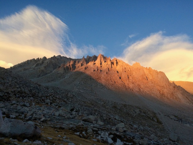
The evening alpenglow spreading across Whitney

IMG_5393

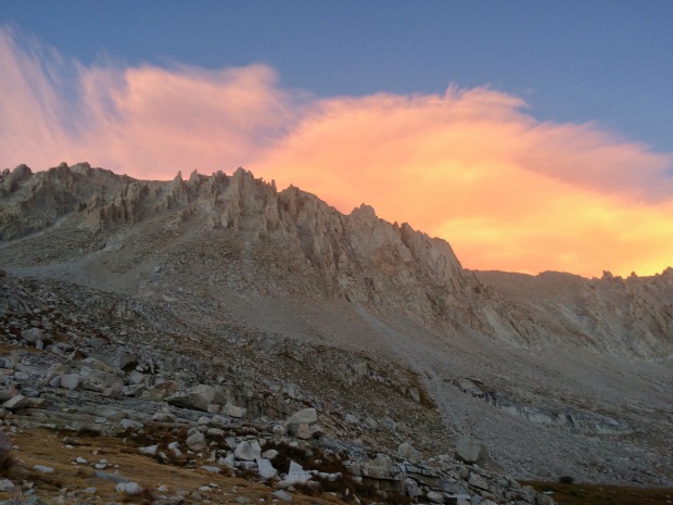
And then the sky lit on fire

IMG_5394

G hanging out for the light show

IMG_5397

Dude.

IMG_5399

Wish this pano didn’t get all cut off and blurry


Darkness came and I was still wide awake, full of anxiety. I don’t think I’d be getting much sleep tonight.

IMG_5410

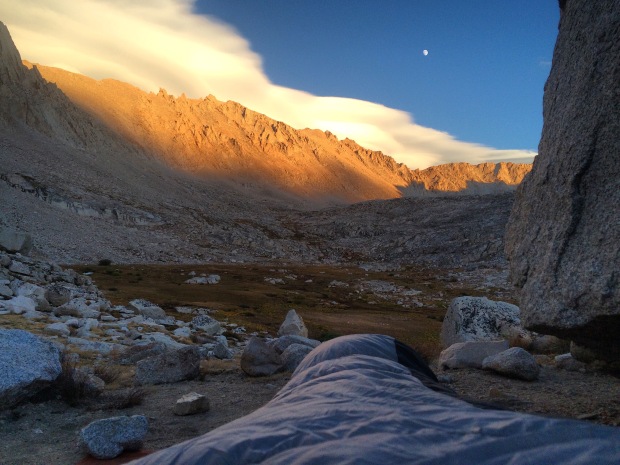
Best place to fall asleep


Day 20: “There’s a Storm Coming, Harry. And We All Best Be Ready When She Does.”

September 11th: Center Basin Creek Crossing – Shepherd Pass Trail Junction (9.3 miles, 2,680′ elevation gain)

Cumulative Distance: 216.9 miles

Cumulative Ascent: 40,045 feet

We set our alarms for 0600, but decided to sleep in until 0700 and were on the trail by 0830.

My first time cowboy camping was a success! I had a couple moments during the night when I was convinced a coyote or bear was going to walk up and eat my face, but being entirely exhausted has its perks because the thought of death-by-creature-chomp-to-the-jugular doesn’t even seem to phase you and you fall right back to sleep. Noted.

It was definitely harder to get up in the morning because I was a bit colder (tents do actually hold in a lot of heat despite how thin they are), but so easy to get everything together and back on the trail. We had some coffee with breakfast and G marveled at my quick gear packing (my flight attendant skills come in handy on the trail, apparently).

It was another long slog up Forester Pass. I always feel so guilty hiking with others because my uphills require a lot of stops for me to catch my breath. Asthma is the pits, man. But G was patient and kind and never made me feel like I was holding him back.

Throughout my entire hike, I had heard about how much of a bitch Forester can be. It’s the highest pass on the trail aside from Whitney and is notorious for fast-moving storms. This would be the highest I’d ever hiked before, and G kept mentioning when I was going slow and being hard on myself that literally each step was breaking a new record once we got above 11,500′. He was right. Every step counted, even if they were spaced ten years apart at the rate I was going.

IMG_5292

Up and up

IMG_5293

Little tarn as we made our way above tree line

IMG_5294

Up and over this terminal moraine (where a glacier pushed all the earth)

IMG_5295

Another beautiful day in the Sierra Nevada

IMG_5297

Gabriel scoping out the trail ahead on a map- complete with snacks

IMG_5298

A long, never-ending slog uphill

IMG_5307

Lake 12,250 (actual name!) with Forester Pass up there somewhere and Junction Peak

IMG_5308

G in his own Ansel Adams backdrop


aah11

Ansel Adams “Junction Peak” c. 1930s

IMG_5309

Yep, still not there yet. Another 800 feet up to go 

IMG_5311

The King-Kern Divide

IMG_5312

Started way down there in those trees only a few hours before


IMG_5314

Lake 12,250 kind of looks like a 8==D, no?

IMG_5315

Still not there, still beautiful

IMG_5316

So close

IMG_5317

These switchbacks were the death of me

Despite the long morning and all the crappy things I had heard about Forester, I really, really enjoyed it. I felt strong and powerful when we got to the top around noon. Unfortunately for us, there was a GIANT tour group up there as well. Or maybe not unfortunately, because they laid out an incredible smorgasbord (every time I use that word I think of the rat in Charlotte’s Web… anyone else? No?) complete with a cutting board full of meats, cheeses, vegetables, fruits, nuts… We were seriously impressed. Chatting with the two guides, they were annoyed with how much food was being wasted each day so far. They had packed a lot of spicy meals and the group consisted of mostly people from England and Australia… where spicy isn’t necessarily the norm like here in Southern California. They told us about how they’d need to throw out a lot at their resupply stop ahead and we gladly offered to take the extra food off their hands. Habanero cheese (!!!!!), meat (for G), Thai chili lime cashews(!!!), Trader Joe’s honey wheat pretzels (!!!)… it was insane and needless to say we feasted like kings that night.

IMG_5318

MADE IT! Pano of Forester Pass from north to south

IMG_5319

G taking in the wide open views south

IMG_5320

Don’t mind me up here drooling and lurking over your food spread

IMG_5322

Northwest side of the pass and Junction Peak

As we sat up there we saw dark clouds building quickly in the distance and then the distant sound of thunder. I wanted to sit up there forever, but we needed to get down before the storm headed our way. Crossing over Forester Pass officially takes you out of Kings Canyon National Park and into Sequoia National Park, which felt incredible to step into another milestone of this hike. The highest I’d ever been, a new park, my first big storm, cheese. It was a pretty impressive day.

IMG_5323

Sketchy clouds building up out there to the east and in the north and south as well

IMG_5328

Me and G getting a quick photo in before heading down

IMG_5333

Storm? What storm?

IMG_5334

The long, flat Diamond Mesa lines the eastern side of the tarns at Tyndall Creek

IMG_5339

G on the south side of Forester

14425376_10210664854725484_1947238875574296795_o (1)

Incredible trail engineering made this pass possible in 1931

Thank god we did head down, because suddenly it was raining, sleeting, hailing, and thundering all around us. We stopped to throw on our rain gear (the first and only time I actually needed it for the entire 200+ mile hike- super lucky, I guess) and carried on. I had wanted to see a plaque on the southern side of Forrester dedicated to the 18-year-old Donald Downs who had died while working on the trail, but we missed it in our downhill haste.

IMG_5341

Getting darker…

IMG_5342

…and darker

IMG_5344

Picking up our pace to get the hell off the mountain

As we neared the bottom of Forester, we met a girl, Jenny, who asked us about the pass, weather, and trail ahead. She was on a mission to break the world record for female JMT NOBO (supported, I believe?) and this storm was messing up her plan. She had left Whitney that morning and was already at the base of Forester before 1400. Insane. She mentioned how the record was currently set at 3 days and 20 hours- I nearly choked in disbelief. That’s how long it takes me to get my ass up one side of a mountain pass. Sitting here now, I just checked the record and it looks like the storm really did mess her up, because the female record remains unbroken. Womp.

IMG_5345

One last look back up before the storm hit

The rest of the afternoon was actually magical. The other side of Forester drastically drops off into a wide open alpine tundra carved out mostly by glacier, but also the steep walls of Diamond Mesa and Junction peak by avalanche. Hiking in the storm was lovely and I had the biggest smile on my face watching the weather around me change so drastically. Every day before had been the same aside from one near-storm I think on Silver Pass, so the storm was welcomed. I grew up in New England, but have been living out here in California for nearly ten years. It was nice to see actual weather to break up the usual “sunny and 75”- making it a cool (albeit wet), easy downhill hike all afternoon for the next few hours and beyond beautiful. Unfortunately the photos stop here because my hands were so frozen and wet, but I did manage to take a couple videos before the storm got worse:

Our plan had been to make it to Bighorn Plateau for the night, but with the weather being as it was, it wouldn’t be smart to be so exposed if lightning were to strike.

We set up a quick camp at Shepherd Pass Junction to get out of the rain, but eventually decided to stay there for the night. We had a great site near the river and weren’t too far off from where we wanted to be.

My dinner was fit for a Khaleesi and I hadn’t been that full in a long time. It amazed me how much my body had resented food the first half of the hike. I had had to force every calorie down and felt awful. Now, however, I was constantly starving and ravenous at meal time.

As we sat around at camp, Tripod and his wife Lauren passed by. They were aiming for Bighorn Plateau as well and decided to push on into the evening since the weather had calmed down. I was seriously impressed with Lauren, she hurt her ankles and knees weeks earlier, but still pushed on. They had to take it slow so she wouldn’t injure herself any further, but I was constantly yo-yoing with them since back in Yosemite at Cloud’s Rest Junction. We chatted with them for a bit and then they were off.

While sitting around at camp I noticed how one of my toes was suddenly itchy. I took off my socks and discovered this fun little rash down the right side of my (pointer?) toe. (Also check out how disgusting my fingernail is in the second photo…) My sister to the rescue: she sent me the perfect bandaid for just this occasion in one of my resupply buckets along with a note about how I always manage to get some sort of foot injury on all my trips. Thankfully, so far, it was just the mild rash and nothing major.

Before bed we read Wenk’s book out loud (or just Liz as we had endearingly started calling her) and discussed our game plan for the day ahead. Getting up to Bighorn would provide us our very first glimpse of Mt. Whitney. We’d finally have the end in sight, and it stirred up a lot of emotions for me that night. I crawled into my tent and laid there in sadness. Sitting up on top of Forester had tipped the scale for me. I was finally, truly, sad. This adventure, this journey, was coming to an end that I never thought I’d reach and at times often resented. The bad days had been unbearable and the good days had passed by so quickly. But here I was, wallowing in a deep, sudden sadness that it would all soon be over. I didn’t want this hike to end and didn’t know how to process this new feeling quite yet. As I sit here typing all this, I think I still don’t. Blogging about the JMT has opened up emotions I had completely forgotten about. People and days and marmots and rivers I had completely forgotten about until I open up my journal to type them out here on my keyboard. I’m thankful I took the time each night to write about every silly little thing (literally every single marmot, pika, dog, deer, pass, crossing, person, experience, meal… all quickly jotted down in shorthand each night for me to transcribe later, now).