We have been all about challenges lately, both challenging ourselves and signing up for challenges we come across on the interwebz. We’re excited to jump into the 52HikeChallenge which is, you guessed it, 52 hikes in a year. A16 is hosting some amazing gigs this year as well that we’ll be posting about soon. But this last hike was aimed to kick off our 6PackofPeaks challenge run by SoCal Hiker.
The challenge is made up of Mount Wilson, Cucamonga Peak, Mount Baldy, San Bernardino Peak, Mount San Jacinto, and San Gorgonio. With the recommended routes, it equals over 27,000′ vertical gain at just over 80 miles on the trail.
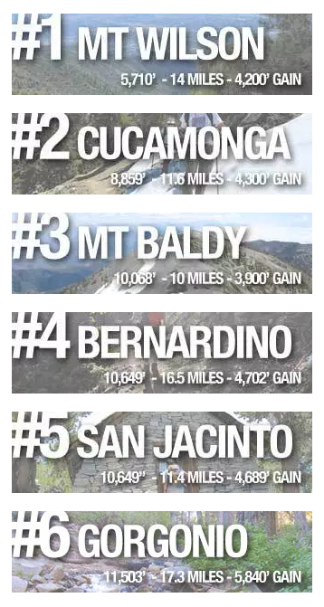
SoCal Hiker’s Six-Pack of Peaks Challenge
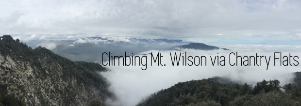
Considering that a few of these peaks are currently under snow, we started with Mt. Wilson the other day.
We were fairly warned about the insane amount of people who go to Chantry Flats, which is where our hike started. With advice to start early (the gate opens at 0600), we arrived around 0930, which was obviously way too late. We had to park our car about a mile away from the main parking lot, adding two total miles to our hike right off the bat, but we weren’t too worried. This spot also requires an Adventure Pass, which we had already purchased for the 2016 season. Make sure your pass is displayed and easily visible on your dashboard or hanging from your rearview mirror, as we noticed many people were getting tickets for not having one. Another thing to note if you have to park down the road is to pay close attention to parking signs and the white shoulder line on the road. Tons of people were getting ticketed because their car wasn’t completely within the designated shoulder area within the white line.
We started hiking from our car just after 1000 up to the trailhead which is to the right of the toilets at the lower parking lot.
Our first mistake was skipping the side hike to Sturtevant Falls. By doing so we missed our trail and ended up following the posted sign to Mt. Wilson via the Upper Winter Creek Trail, which would have been fine, but we somehow managed to hop on the Mt. Zion Trail before realizing we should have been at Spruce Grove Camp by that point. However, the wild flowers on this part of the trail were untouched and beautifully in bloom, which was a nice treat.


We decided that even though we were already over three miles off course, we’d continue back down to Spruce Grove and continue on from there. On our way, we crossed paths with two California mule deer.
We met up with Sturtevant Trail and quickly came to the most difficult part of the hike up numerous switchbacks. This area is steep and with every single switchback you wonder how much longer until the top. Eventually you’ll get to the wooden Halfway Rest sign (1.4 to Wilson and 1.4 back down to Sturtevant), which was ironically hopeful instead of daunting. We knew how much farther until the top and powered onward and upward.

“Whoooa, we’re halfway theeere!”
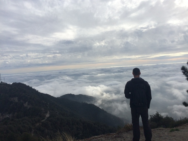
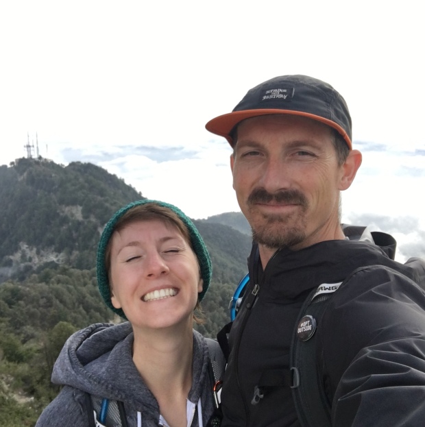
We had picked an amazing day to hike. The weather was cold with the occasional light rain shower. When we arrived at the top of Mt. Wilson, the view was incredible above the clouds. We could see nearby peeks peeking out through the top. Every now and then we would stop to watch the quickly moving weather sweep across the mountains.

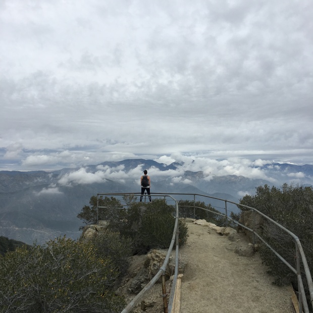
A nice little vista point at the top
Jace taking in the view
With time not exactly on our side, we were bummed to not be able to enjoy the museum and check out all the different telescopes. We followed the paved road past all the structures to the main parking lot to meet up with the Winter Creek trailhead via Mt. Wilson Toll Road. We took a minute to walk over to the boulders at the end of the lot to look down over LA, but the cloud cover blocked our view, which was still an incredible sight. Glancing back over our shoulders at the Cosmic Cafe, we wished we had time to grab a hot cup of anything to warm us up before heading down.

Following the trail on the right side of the parking lot, it eventually intersects with the toll road. Continue downward on the trail to the left and when you come to a large bend to the right, you’ll see a sign for Winter Creek Trail on the left.
We continued down to Winter Creek with our knees aching. It’s always funny how much you look forward to descending on your way up, just to end up regretting that feeling on you way down.

ominous-looking fog
We arrived at Hoegee’s Camp with the sun starting to set. At this point you can either follow Lower Winter Creek Trail and then climb a short distance back up to Chantry Flats or follow the longer Upper Winter Creek Trail to come out on top of Chantry Flats. We wanted to try to get to our car before dark, and actually looked forward to a bit of an uphill climb at the end, so Lower it was.
As we hiked along the creek all of a sudden we noticed hundreds and hundreds of red salamanders all over the trail. Whenever we came to a crossing we’d look into the water and saw them huddled around rocks in the pools. Turns out, they are California Newt and it was most definitely mating season. Also turns out that the glands in their skin secrete a toxin stronger than cyanide, which can actually kill humans if ingested or through cuts in the skin.

Cute, yet deadly
Our hike was incredibly slowed for most of the remainder of the trail down due to avoiding the litter critters. We had to turn on our headlamps to make sure our path was clear.
Right before the sun set, we each heard a rumbling in the leaves next to us and some heavy steps. We both froze and immediately looked at each other with the face of, “Oh shit, did you hear that too?!” We turned off our lights and tried to see what was making so much noise. Up the hill a bit we saw what looked like either a baby or adolescent black bear either digging or dragging something. Not wanting to discover if mom was around, we quickly hurried away.
After a short hike back up to Chantry Flats and down the road, we arrived at our car well into the evening. The drive back down the mountain was beautiful with the views of all the lights from Los Angeles below.
With our silly detour and the added mileage to and from the car, our day ended with over 19 miles and about a 6,000′ elevation gain.
Our first summit of the Six-Pack of Peaks challenge: Complete!
Squinty-Mc-Squinters

Love it!
LikeLiked by 1 person